News
Severe Storms and Tornado Warnings Hit Oklahoma Overnight
OKLAHOMA CITY, Okla. — Severe storms, including multiple tornado warnings, impacted parts of Oklahoma overnight on Tuesday, June 17, 2025. The KOCO 5 First Alert Weather Team reported strong winds and heavy rainfall as storms moved across the state.
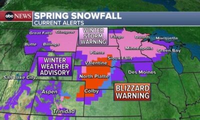
According to Chief Meteorologist Damon Lane, northern and eastern Oklahoma faced a flood watch until Wednesday morning. Thunderstorms were expected to develop in the Oklahoma City metro area during morning commute hours.
As storms advanced, wind gusts reached up to 70 mph in some regions. Radar showed storms moving from Woodward to Tulsa, with additional storms predicted to hit Stillwater and the OKC metro area. The storms carried potential for isolated tornadoes.
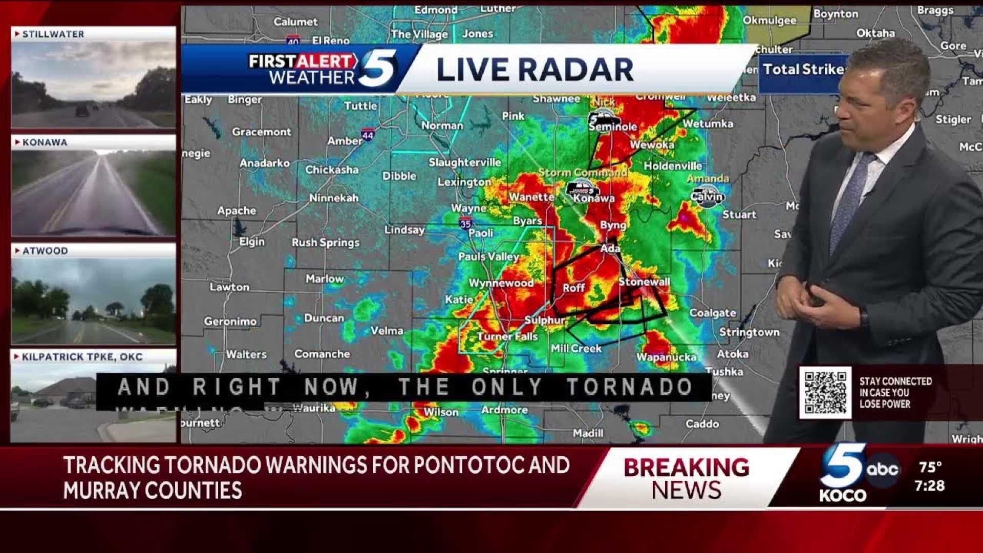
Several tornado warnings were issued throughout the night. For instance, a warning was dropped for Lincoln and Pottawatomie counties around 11:41 p.m. However, warnings for Kay and Noble counties remained active due to ongoing severe thunderstorms.
Reports indicated significant rainfall, with some areas recording over two inches. The Oklahoma State reported no drought conditions across the state.
As storms continued, the National Weather Service confirmed the presence of two tornadoes in Delaware and Cherokee counties. Tornado warnings extended until 1:30 a.m. for multiple regions, urging residents to seek shelter immediately.
The storms caused power outages in certain areas and created hazardous driving conditions on Interstate 40, where traffic was stalled due to storm-related disruptions. Field Meteorologist Michael Armstrong reported trees and structures damaged by the severe winds.
Authorities advised residents to stay informed and prepared as the severe weather continues to impact the region.