Nor’easter Threatens East Coast with Heavy Rain This Weekend
Washington, D.C. – A nor’easter is set to develop this weekend, bringing severe weather to the East Coast. The storm is expected to bring strong winds and heavy rain to areas from Florida to the Carolinas and the mid-Atlantic.
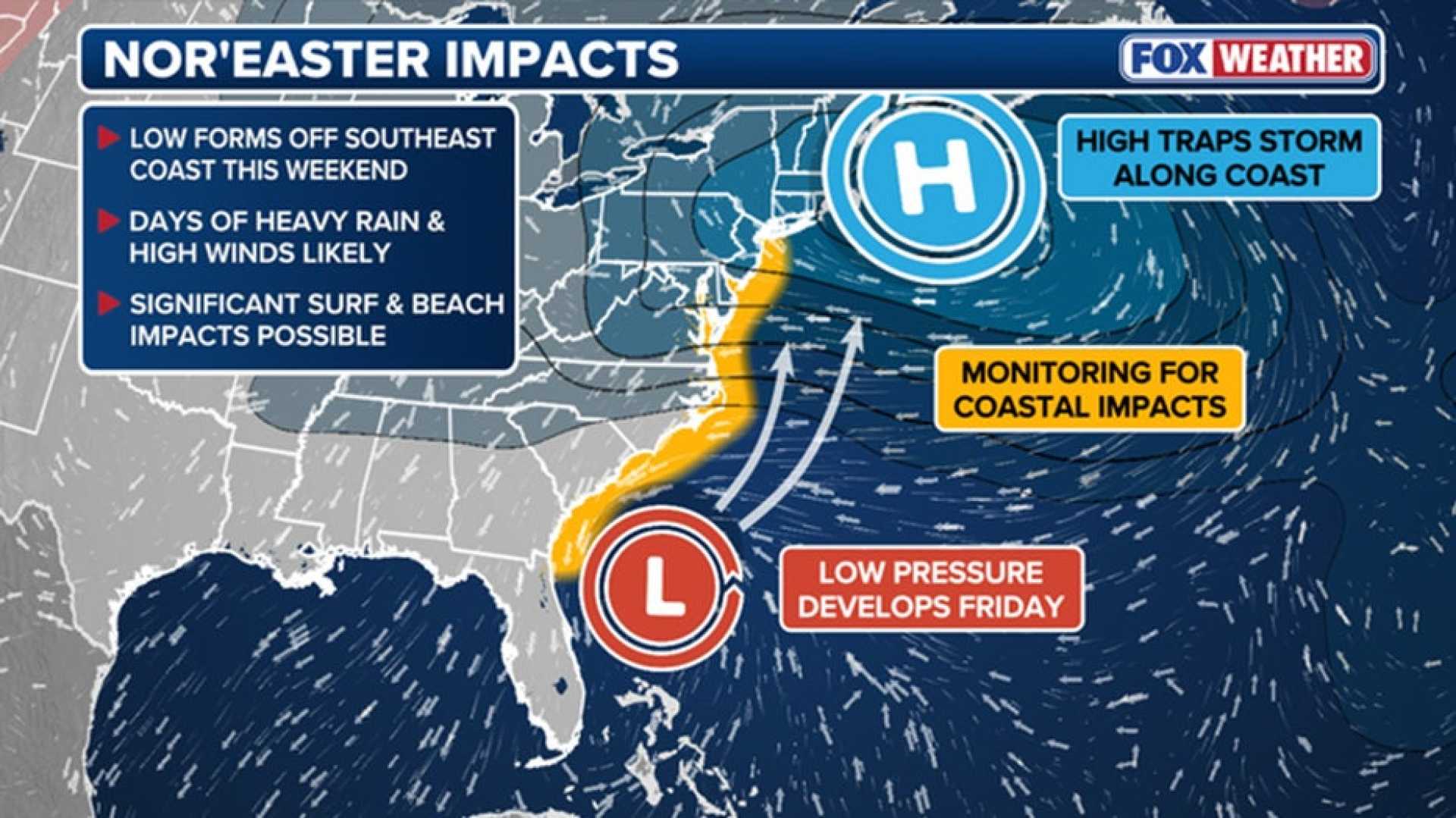
The event will begin with a cold front moving east across the United States, followed by cooler autumn weather in its path. By the end of the week, this front will stall over the Southeast, allowing the nor’easter to form on Saturday just off the coast.
The Weather Prediction Center has informed that the nor’easter could be a “full-fledged” coastal storm with significant impacts, including high winds and coastal flooding. At least seven unoccupied homes in Buxton, North Carolina, have been lost since September 30 due to wave action and erosion.
Nor’easters are storms characterized by winds coming from the northeast, typically bringing heavy precipitation. Though they are most common from September to April, they can occur at other times and can be severe.
There are two likely scenarios for the nor’easter’s path. One scenario predicts it will strengthen off Florida and South Carolina, staying close to the Carolinas until at least Tuesday. This would bring significant rainfall—up to half a foot—and gusty winds. The second scenario suggests that the storm will track northward along the coastline, minimizing the duration of severe weather in the Southeast but still affecting the mid-Atlantic.
Eastern North Carolina is expected to face the worst of the storm, with localized flash flooding possible. Parts of the Outer Banks may receive nearly 6 inches of rain.
Winds are forecasted to intensify starting Friday, with gusts up to 50 mph in the Outer Banks and 20 to 40 mph for the eastern mainland. Coastal flooding could also be a concern, as tide levels approach peak highs for the month.
After the nor’easter dissipates or moves away, the region may see a brief break before another wave of warm weather returns late next week.