News
Severe Weather Threat Looms Over the South This Week
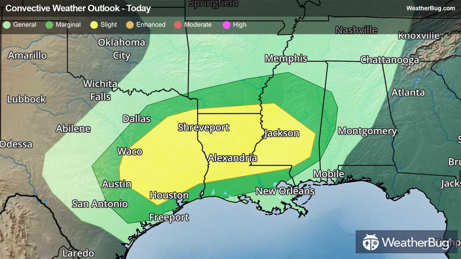
Nashville, Tennessee — A significant weather system is expected to bring severe storms to the South on Tuesday, with the possibility of damaging winds, hail, and even some tornadoes. According to the National Weather Service (NWS), warm and humid air is reacting with a cold front, creating conditions for storms from Tuesday morning into the afternoon.
The Storm Prediction Center has issued a level 1 out of 5 risk for severe weather in the WEAR-TV viewing area, while parts of Alabama and Mississippi face a higher level 2 risk. This means that isolated severe storms could develop, particularly in eastern Mississippi and Alabama.
“The main threats include wind gusts potentially exceeding 60 mph and quarter-sized hail,” said meteorologists with the NWS. “There is also a low-end risk for brief tornadoes.” The severe weather is expected to start early Tuesday and may persist throughout the day.
Travel plans could be affected due to the severe weather conditions. However, forecasters predict that the system will clear out by Wednesday, leading to cooler and drier weather just in time for Thanksgiving.
The NWS has advised residents to stay informed and be prepared for changes in weather. Heavy rainfall may bring beneficial moisture, with some areas in northern Alabama expected to receive up to 2 inches by Wednesday.
As the storm system moves through, parts of the northern United States are also under winter storm watches, anticipating heavy snow and strong winds, further complicating travel conditions in those regions.
Weather experts recommend having multiple ways to receive alerts, especially overnight, when storms are predicted to be at their peak. Safety measures are essential to stay informed about the evolving situation.


