News
Winter Weather Advisory Issued for Chicago Area Amid Snowfall
CHICAGO, IL – A winter weather advisory is set to take effect Monday afternoon for the entire Chicago area, bringing the potential for accumulating snow and slippery conditions just before the evening commute. According to the National Weather Service (NWS), the advisory will begin at 2 p.m. and last through midnight.
This advisory follows a powerful winter storm that brought significant snowfall across northeastern Illinois over the Thanksgiving holiday weekend, leaving some areas blanketed with more than four inches of snow.
In the morning, weather experts warned of shallow freezing fog which could reduce visibility and create slick roadways. This fog was reported locally, especially outside of Chicago, and is expected to lead to patchy icy conditions.
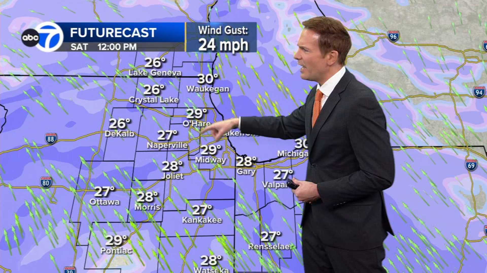
Snow is anticipated to move in from the west around 12 p.m. on Monday and will spread eastward throughout the afternoon. By 3 p.m., snow is expected to cover the entire Chicago area, leading to hazardous conditions for those heading home from work. NBC 5 Storm Team Meteorologist Alicia Roman cautioned that mixed snow and difficult driving conditions could result in dangerous roads as people leave work between 5 p.m. and 5:30 p.m.
The Chicago Office of Emergency Management and Communications has advised drivers to prepare for slippery conditions, urging them to slow down and exercise caution while driving.
Projected snow totals for the day vary between 2 to 3 inches in areas north of the city and 2 to 4 inches in regions south of Interstate 80. Roman noted that specific areas, like Waukegan, might see about 1.1 inches, while Kankakee could receive up to 3.0 inches.
The snowfall is expected to taper off by late evening, but Monday’s high temperature is forecasted to be 29 degrees, dropping into the teens overnight.
As the week progresses, significantly colder air is expected to move in by Thursday, with lows potentially near zero.


