News
Dangerous Fire Conditions Expected Today in Central Florida
ORLANDO, Fla. — Central Florida is set to experience warm and sunny weather today, but a Red Flag Warning has been issued due to hazardous fire conditions that will last until 7 PM EDT. The National Weather Service (NWS) issued the warning as strong winds coupled with low humidity levels increase the risk of fire.
This afternoon, residents can expect high temperatures in the mid-80s, with winds sustained at 10-15 mph and gusts potentially reaching 25 mph. According to NWS, humidity levels will be between 30% and 35%, raising concerns about rapid fire spread. Outdoor burning is strongly discouraged, and residents are urged to exercise caution.
The warning encompasses regions including Orlando, Volusia, Brevard, and surrounding counties, affecting areas such as Daytona Beach, Winter Park, and Kissimmee. “Conditions this afternoon are conducive to fire spread, and any fires that develop could expand quickly,” a NWS spokesperson stated.
As the day proceeds, some isolated showers may develop in northern Flagler County around 3 PM, but most of the day will remain dry. A cold front is expected to bring in rain and possibly thunderstorms late tonight. Showers are anticipated to clear before sunrise on Saturday morning.
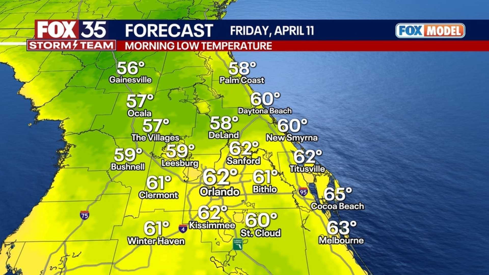
This weekend is predicted to be sunny and pleasant, with Saturday temperatures peaking in the mid-70s and increasing to the low 80s on Sunday. Morning temperatures will dip into the 50s, with potential pockets of upper 40s north and west of Orlando.
Looking ahead to Monday, after a chilly start, the day will warm up to the mid-80s under mostly sunny skies. Similar warm temperatures are expected for the rest of the week, but continued dry conditions could raise fire risks in the upcoming days.
“We advise residents to remain vigilant as we face these elevated fire risks. Preparedness is key,” local authorities warned.


