Halloween Storm Brings Rain and Chilly Weather to Eastern U.S.
WILMINGTON, NC – A storm system moving off the coast of the Southeastern United States is set to bring heavy rain to the Carolinas, the southern Appalachians, and parts of Virginia through Wednesday. The National Weather Service (NWS) reports that coastal areas will experience gusty winds and rain showers that may lead to beach erosion.
The NWS in Wilmington stated that temperatures along the coast will be in the lower 60s, while inland areas will see highs in the mid-50s. Northeastern winds are expected to gust between 25 to 30 mph. Additional rain may accumulate to a few tenths of an inch by the end of the day.
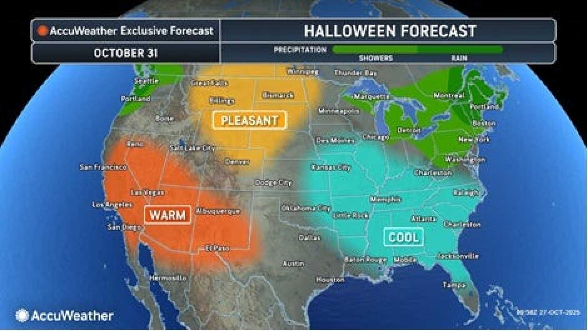
As the week progresses, another area of low pressure moving from the Upper Midwest to Texas on Tuesday will track eastward, soaking the mid-Atlantic and Northeast later in the week. Rain from this system could complicate Halloween festivities, particularly for trick-or-treaters.
Forecasters expect 1-2 inches of rain across much of the central U.S. and Northeast by the end of the week. Although some areas may experience wet conditions during Halloween night, meteorologists say that most of the country will see clear skies.
In particular, the Outer Banks of North Carolina, which have already faced significant erosion this season, are under a Coastal Flood Warning through Wednesday. Coastal Flood Advisories are also in effect for other parts of North Carolina and Virginia.
While the rain is persistent now, forecasts indicate improving weather by late Wednesday, allowing for a drier Halloween eve for many. Areas that were previously affected by heavy rains remain on alert for possible flash flooding, especially in western North Carolina.
Overall, the week leading to Halloween is marked by on-and-off rain in the Appalachians and the mid-Atlantic, with temperatures hovering 10 to 15 degrees below normal. Residents are advised to stay updated with local forecasts as conditions develop.