News
Heat Alerts and Thunderstorms Expected in New Jersey This Weekend
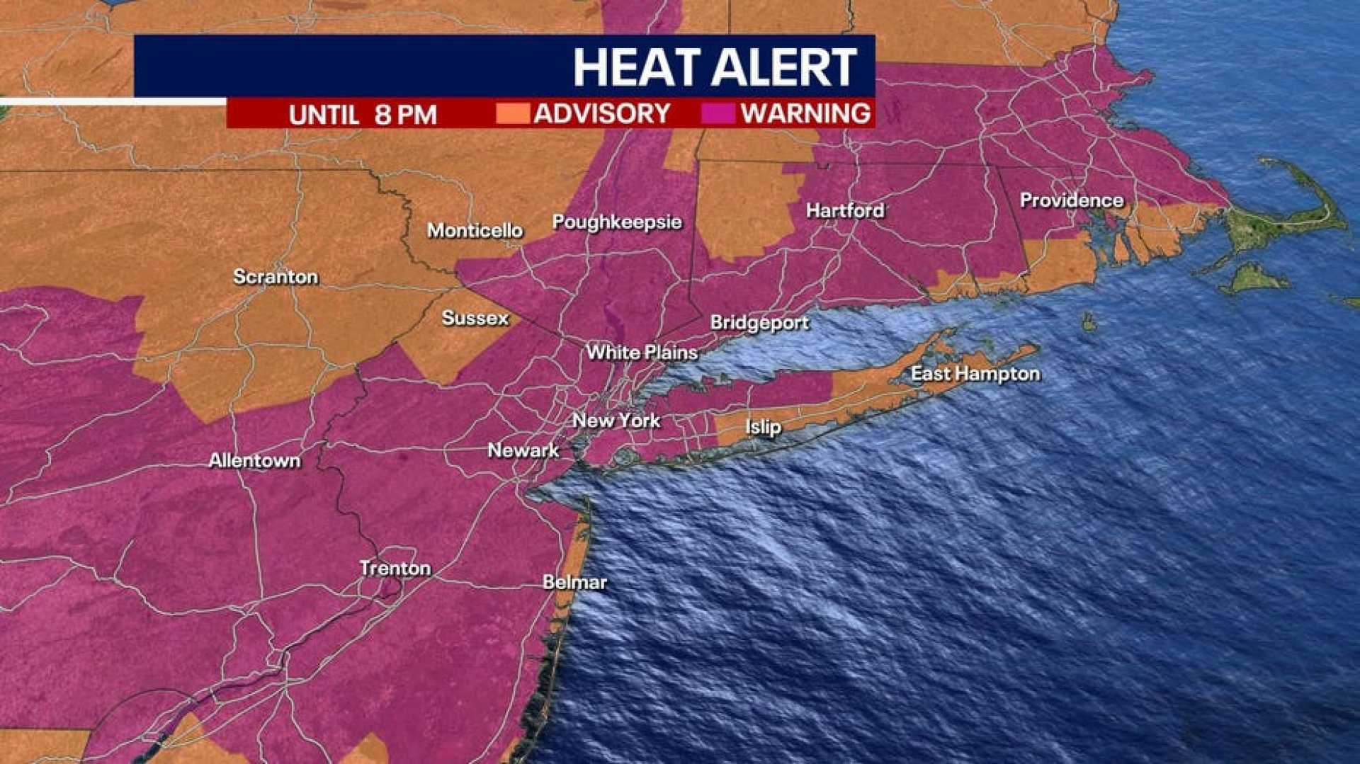
Trenton, New Jersey – A heat alert has been issued for 16 counties in New Jersey as temperatures are expected to rise into the 90s with high humidity. The alert, classified as level three on a six-tiered system, advises residents who are sensitive to air quality to limit outdoor activities during peak afternoon hours.
Thursday may mark the first day of the year to reach 90 degrees in many areas. Scattered thunderstorms are possible, particularly in the northern parts of the state. These storms could potentially bring large hail and damaging winds, although the overall threat remains low.
In urban areas, temperatures will likely climb into the low 90s, while surrounding regions may see highs in the mid to upper 80s. The thunderstorms are anticipated to dissipate by evening, leading to a muggy night with temperatures dropping to the upper 50s to mid-60s overnight.
A cold front is expected to move slowly south, resulting in increased cloud cover and the chance of patchy fog. The weekend forecast indicates a significant drop in temperatures, with highs expected to reach only the low to mid-70s on Saturday and Sunday.
Friday’s weather will bring highs in the 70s to near 80 degrees, with growing chances of showers. By Saturday, cloudy conditions and persistent showers are anticipated. Extended forecasts suggest continued unsettled weather into early next week, including several waves of low pressure that may bring more rain.
Meteorologists advise residents to remain prepared for rapidly changing weather, as potential heavy rainfall and temperature drops are on the horizon.


