High Fire Danger Looms as Spring Storm Approaches Southern Colorado
COLORADO SPRINGS, Colo. — Southern Colorado is bracing for high fire danger due to strengthening winds and unseasonably warm temperatures. A Red Flag Warning is in effect today from 10 a.m. to 9 p.m. as gusts are expected to reach between 50 and 60 mph, significantly increasing the risk of fire.
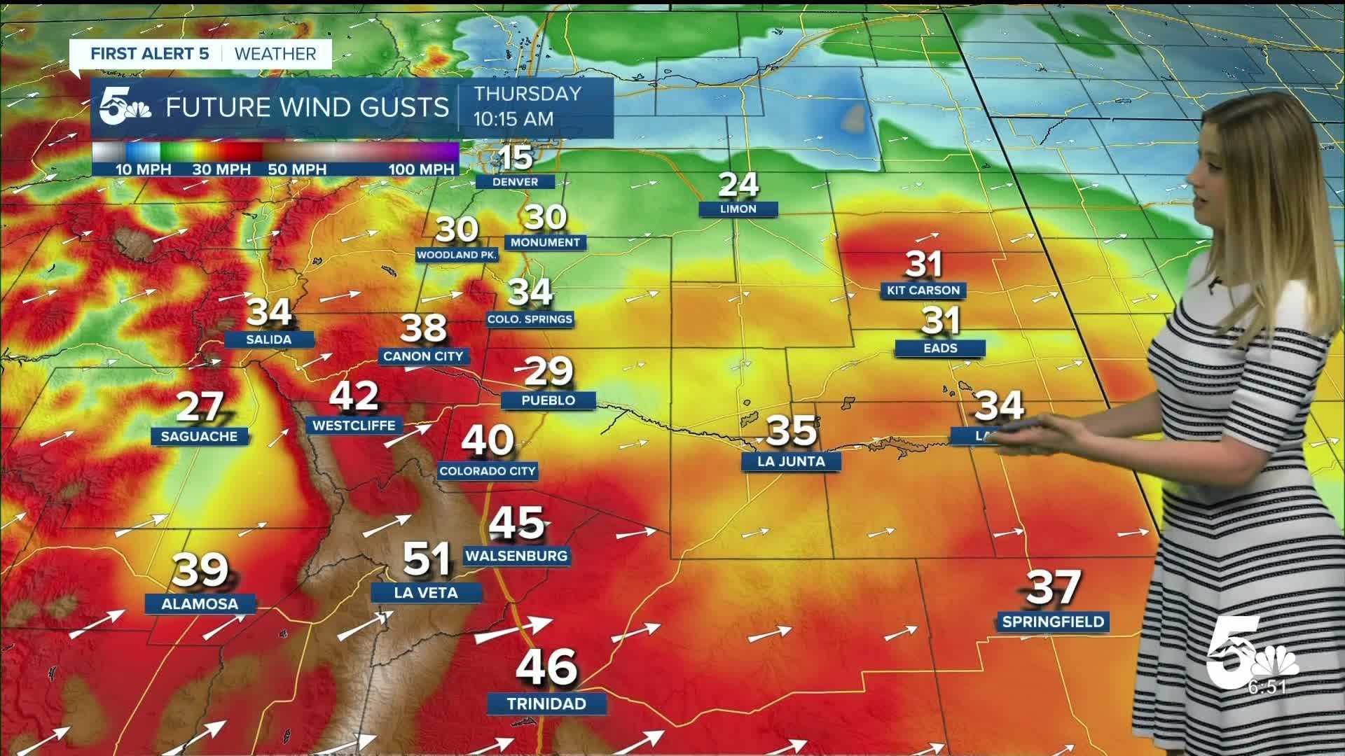
The National Weather Service warns that wind gusts are anticipated to peak around 30 to 40 mph throughout the region, especially south of Highway 50. With temperatures in the 70s and 80s, the conditions are ripe for rapid fire spread, should any ignite.
“If a fire were to start, it could spread quickly in these conditions,” said a representative from the National Weather Service. “We urge residents to exercise utmost caution.”
For today in Colorado Springs, temperatures are projected to reach a high of 77 degrees, with overnight lows around 45. This warm-up marks a shift of roughly 5 to 8 degrees from yesterday, with the high being more than 15 degrees above average for this time of year.
Pueblo is set to experience even higher temperatures, with a forecasted high of 85 degrees. The average for late March typically hovers around 67 degrees, underscoring the intensity of the current weather pattern driven by southwest winds.
Alongside Pueblo, Canon City is also preparing for a balmy day, with temperatures expected to hit 81 degrees, under a similar Red Flag Warning that will remain in effect from noon until 8 p.m.
Looking ahead, moisture is expected to move into Colorado late this evening, slowly advancing southward. Rain and snow showers could begin impacting commuters during Friday’s morning rush hour.
Forecasters predict that, initially, the snow may not stick, but as temperatures drop, accumulation is likely, particularly in higher elevations. Colorado Springs could see several inches of snow, while areas like Woodland Park may receive between 4 to 8 inches, impacting travel over the Easter weekend.
“Wet weather is anticipated to complicate travel plans during the holiday weekend,” cautioned National Weather Service officials. “Be prepared for changing conditions.”
Saturday is forecasted to remain chilly with snowfall continuing throughout the day, though it is expected to taper off by the evening. Temperatures will remain cooler, before bouncing back into the 50s and 60s for Easter Sunday, which looks to be mostly dry.
“We’ll see a transition to a milder day for Easter, but it’s advisable to keep an eye on travel conditions,” said NWS officials. “Always check the latest forecasts and stay informed.”