High Winds and Cooler Temperatures Hit Iowa This Weekend
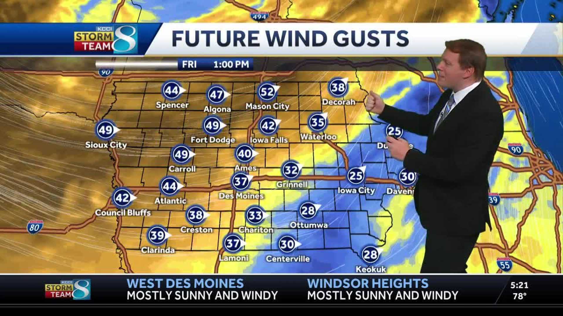
DES MOINES, Iowa — A cold front swept through Iowa on Friday, bringing strong winds and cooler temperatures. Gusts reached between 40 to 50 miles per hour in many areas, with some northern regions experiencing even stronger gusts.
The National Weather Service issued warnings as the winds caused dust and debris to fly, affecting visibility in several communities. “We are seeing some very strong winds due to the cold front, and they will last into the evening,” a meteorologist stated.
Temperatures dropped swiftly throughout the day, starting at highs near 80 degrees but falling to the mid-70s by the afternoon. After sunset, the temperature is expected to slide into the mid-50s.
Wind gusts are predicted to return on Saturday, reaching 35 to 50 mph in many areas. Cloudy conditions will likely persist, alongside the chance of light showers in northern Iowa. The best chance for rain is expected to be north of Highway 30, with little to no rain anticipated in the central metro region.
Looking ahead to the weekend, the forecast suggests a chance for lighter winds and clearer skies on Sunday, with highs around 70 degrees. However, another storm system is projected to bring a return of rain starting late Sunday night.
“We could see several rounds of showers and thunderstorms as we move into Monday and Tuesday,” the forecaster warned. Rainfall totals could range from a half-inch to 1.5 inches, depending on the storm’s path. While severe weather is expected to stay south, including areas in Kansas and Missouri, residents in Iowa should stay alert for any updates.