News
Houston Faces Rain and Storms Ahead of Cold Front This Week
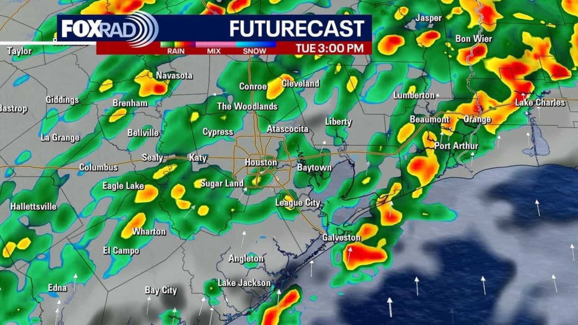
HOUSTON, Texas – A FOX 26 Storm Alert Day is underway as the region braces for morning fog and drizzle, expected to escalate into scattered thunderstorms by midday Tuesday. The National Weather Service anticipates localized rainfall amounts of 3 to 4 inches, especially along and north of Interstate 10, creating potential for street flooding from Tuesday afternoon through early Wednesday.
Heavy downpours are forecast throughout the day, with high temperatures reaching the mid-70s. In preparation for these conditions, commuters traveling along I-45, I-10, and I-69 should brace for slower travel times and exercise caution in low-lying areas prone to flooding. The chance of precipitation is approximately 80%, with storms likely occurring between 9 a.m. and noon.
The potential for hazardous weather continues into the evening as isolated storms threaten through nightfall. Forecasters are warning that while a widespread severe weather outbreak is not expected, isolated strong storms could bring gusty winds and heavy rainfall.
Looking ahead, a cold front is projected to sweep through Houston on Wednesday afternoon, clearing the rain and bringing significantly cooler air. After the front passes, temperatures may drop to the 40s during the nighttime from Thursday through Friday, with daytime highs struggling to reach the 60s.
The cold front is expected to deliver a brief respite from the rain, with forecasts showing partly sunny skies for Thursday. However, the weekend could bring additional storms, as meteorologists are predicting another system to develop on Saturday, leading into the Presidents Day holiday.
“While we aren’t anticipating widespread flooding, drivers should remain alert for water-covered roads and changing conditions,” said a spokesperson for the National Weather Service. “Prepare for possible travel disruptions as the weather evolves.”
The unsettled weather pattern over the next week includes chances of rain returning as another cold front approaches. Early estimates suggest areas north of Sugar Land and Pearland could experience rainfall between 0.5 to 1.5 inches, while coastal areas might see much less, around 0.1 to 0.25 inches. Temperatures will also fluctuate, leading to a mid-February roller coaster effect.
Valentine’s Day on Friday is predicted to be mild with near-average temperatures and little chance for rain. As the days progress, meteorologists advise residents to keep updated on forecasts to stay informed of any weather-related developments.


