New England Braces for Winter Storm with Snow and Ice This Weekend
MANCHASTER, N.H. — A significant winter storm is expected to impact New Hampshire starting late Friday night, bringing snow, wintry mix, and rain through the weekend. A winter storm watch has been issued for several counties, including Coos, Grafton, Carroll, Sullivan, Merrimack, Belknap, and Strafford.
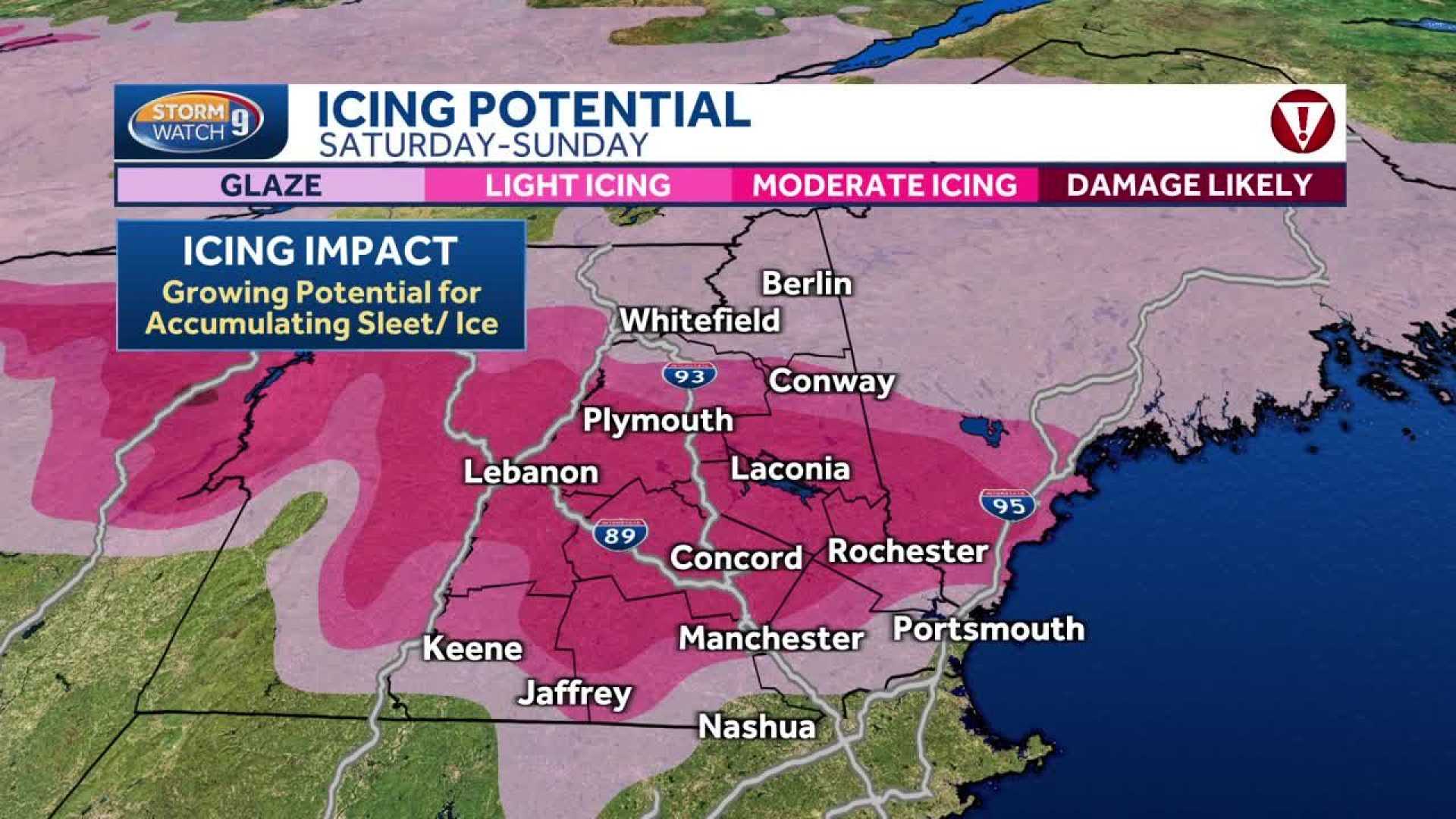
Initially, snowfall will blanket the northern half of the state late Friday into Saturday morning. As temperatures hover around freezing, southern regions may see a mix of sleet and freezing rain intermixed with rain and scattered snowflakes. Authorities caution that roads could become slippery, particularly in areas north and west of Concord on Saturday morning and afternoon.
The White Mountains and Great North Woods can expect snow accumulation of several inches by Saturday before conditions shift to a wintry mix, with warmer air moving in later that day. This influx of milder air should raise temperatures above freezing across parts of southern New Hampshire.
According to the National Weather Service, areas inland south of the mountains are likely to experience the most prolonged periods of freezing rain. This wintry mix is expected to persist throughout Saturday, potentially resulting in hazardous travel conditions.
“Be aware of the treacherous conditions as roads will likely be very slippery where ice accumulates, and isolated power outages are a possibility,” a weather service spokesperson stated.
By Sunday, freezing rain and sleet are expected for northern and central New Hampshire, while areas from Concord southward can anticipate rain. Mondays will bring widespread rainfall, helping to wash away any residual snow and ice.
Snowfall rates could exceed 1 inch per hour in northern regions on Saturday morning. Higher elevations may accumulate more than 6 inches of snow, especially in mountain areas, with some sleet accumulation expected as well. The winter storm watch is in effect until 8 p.m. Saturday.
As the storm progresses into Monday night, conditions are predicted to clear, ushering in a return to sunshine for Tuesday and Wednesday. Residents are encouraged to stay tuned for continued updates from the Storm Watch 9 team.