Polar Vortex Collapse Expected to Hit North America in Mid-March
United Kingdom, February 28, 2025—Meteorologists are predicting a significant collapse of the polar vortex in mid-March, which experts believe will have a more powerful impact than the recent disruption observed in February. This forecast marks the second major disturbance of the polar vortex this year, likely affecting weather patterns across North America.
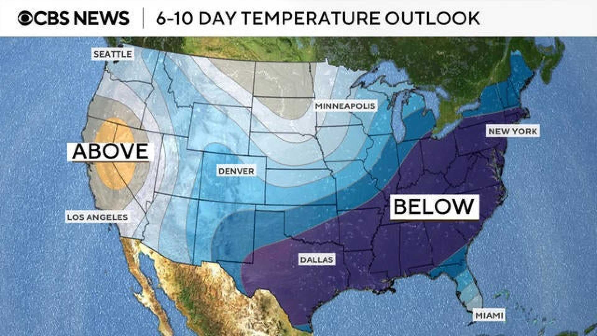
The first disruption in mid-February coincided with a strong cold air release that heavily impacted the central and eastern United States. Forecasters now warn that this upcoming event might cause dramatic weather changes, with the polar vortex not expected to make a return until the next winter season.
Initial effects of this event are already being felt across the U.S. and Canada. The Met Office describes the polar vortex as “a circulation of winds high up in the stratosphere, up to 30 miles above the earth.” During winter, it tightens, ultimately sending colder air southward and lowering temperatures.
The polar vortex’s winds can exceed speeds of 155 miles per hour, comparable to those of Category 5 hurricanes. This year’s extreme weather has already forced the National Weather Service to issue cold weather advisories for more than 93 million Americans as temperatures plunge below freezing.
According to the FOX Forecast Center, Arctic air has moved down into the Lower 48 states, with recent low temperatures recorded at -39°C in Bismarck, North Dakota, marking the coldest day there since January 2009. Regions in Texas, such as Dallas, are also feeling record chills, experiencing conditions akin to the infamous Texas freeze of 2021.
A strong polar vortex typically aligns with a consistent jet stream, which helps keep cold air contained in the polar regions. Conversely, when the polar vortex weakens, the jet stream can falter, leading to erratic weather patterns. This weakening has implications not just for North America but also for the United Kingdom, where similar colder patterns may emerge.
“In a typical UK winter, the jet stream brings winds from the west, resulting in our mild and damp climate,” said a Met Office representative. “However, disruptions in the polar vortex often skew this, allowing for northerly winds that carry cold Arctic air to the UK.”
The mechanics of a polar vortex collapse include what meteorologists refer to as Sudden Stratospheric Warming (SSW), a process where stratospheric temperatures can rise rapidly, disrupting established wind patterns in the stratosphere. As temperatures increase, the polar vortex can weaken and lead to cold air moving south into mid-latitude regions, resulting in colder and more extreme weather in places like the U.S. and the UK.
“The cold air from high in the stratosphere disperses and can affect the shape of the jet stream,” explained a Met Office spokesperson. “It is this change in the jet stream that causes fluctuations in our weather.”
As meteorologists continue to monitor these developments, they emphasize the importance of staying informed regarding possible weather advisories during this period. With cold snaps anticipated, preparations can be critical in minimizing impacts on daily life, economic stability, and industries such as agriculture and transportation.
In conclusion, as the potential for a polar vortex collapse looms, community awareness and preparedness efforts will be essential in navigating the expected weather challenges ahead.