News
Severe Storms and Arctic Blast Threaten Southern U.S.
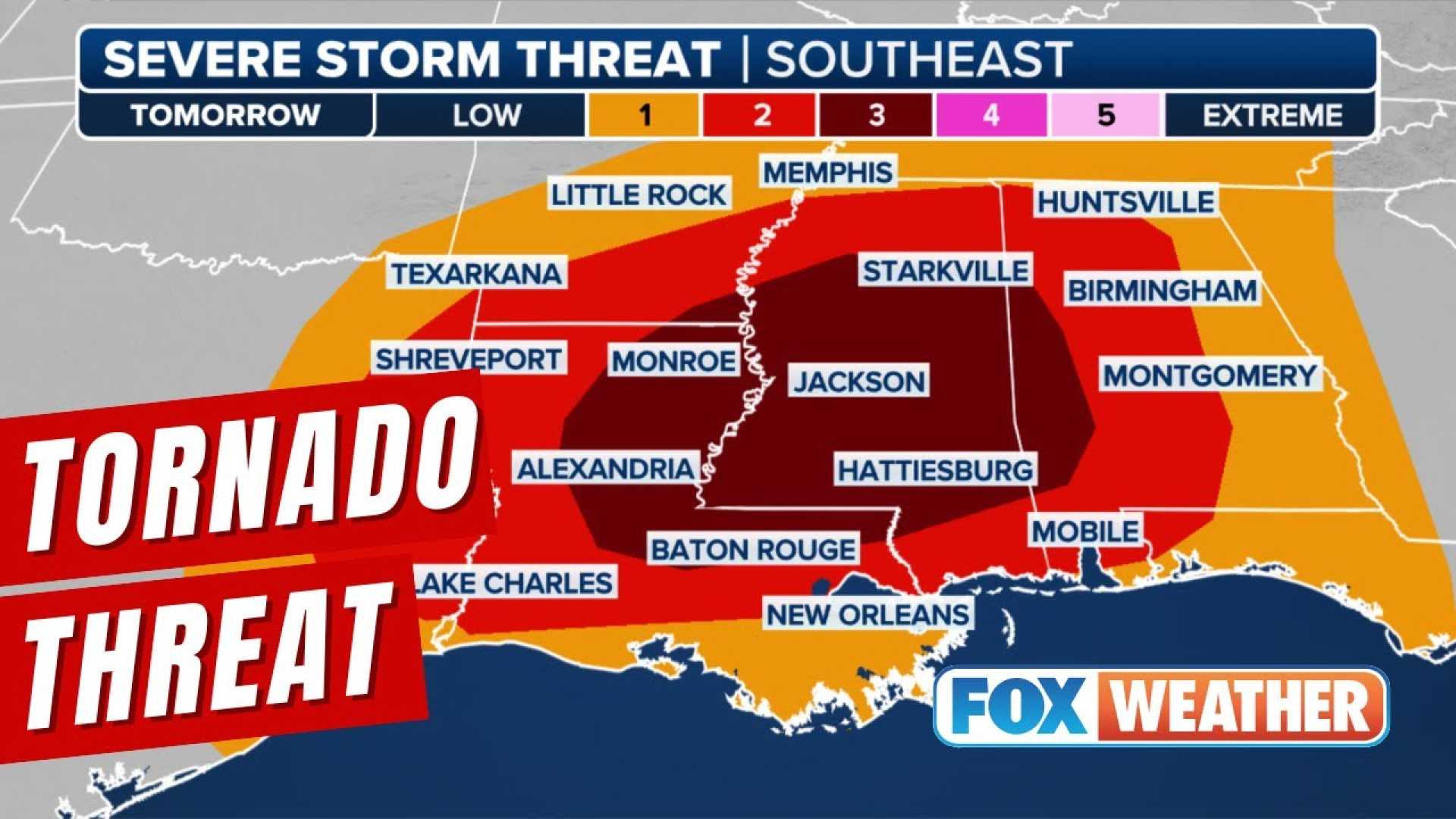
BATON ROUGE, La. (WAFB) – A powerful squall line is set to sweep across the South on Sunday afternoon and evening, bringing the threat of damaging winds, hail, and isolated tornadoes. The National Weather Service has issued a Tornado Watch for areas along and north of the I-10/12 corridor until 9 PM, with the primary concerns being damaging winds and potential tornadoes embedded within the storm system.
The severe weather is expected to impact the local area tonight, with showers and thunderstorms gradually tapering off around midnight. Residents are urged to stay alert and have a plan in place in case of severe weather warnings.
Following the storms, an Arctic blast will bring a dramatic drop in temperatures. Sunday’s record-breaking highs in the low 80s will give way to Monday’s struggle to reach the mid-40s. Breezy winds overnight will add to the chill, with low temperatures around freezing and wind chills in the 20s for much of Monday morning. The cold snap is expected to persist throughout the week, with temperatures not forecast to reach 50 degrees until Friday.
Later in the week, an area of low pressure is expected to form in the Western Gulf of Mexico, bringing a chance of rain Thursday evening through Friday. While no wintry precipitation is anticipated, rainfall amounts could reach 1-2 inches in some areas.
Residents are advised to stay updated on the latest weather forecasts and prepare for rapidly changing conditions. The combination of severe storms and a sharp temperature drop could create hazardous travel conditions and increase the risk of hypothermia for those unprepared for the cold.


