News
Severe Storms Expected Sunday in Central Florida
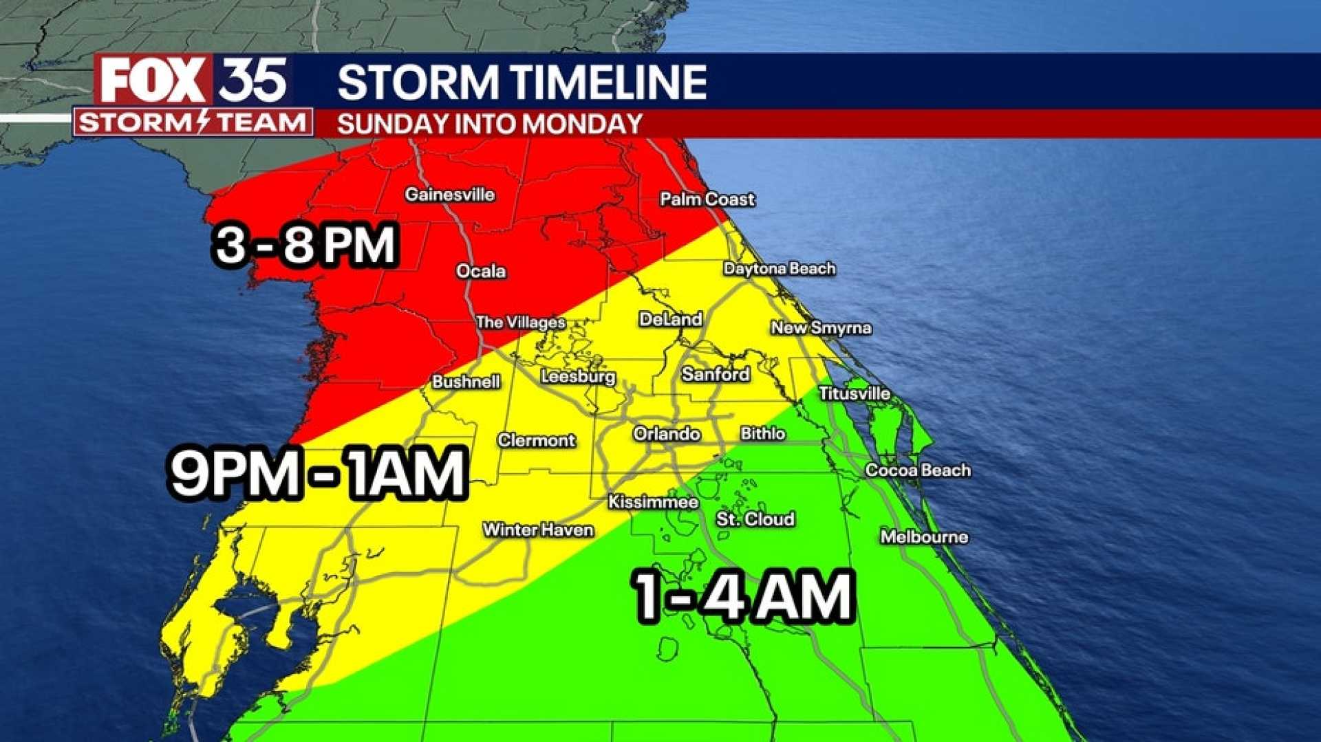
ORLANDO, Fla. — Central Florida is preparing for severe storms set to impact the region on Sunday afternoon, May 4, as a cold front approaches.
According to Chief Meteorologist Tony Mainolfi, conditions will worsen, bringing a higher chance for strong storms from 1 p.m. to 8 p.m. on Sunday. “Computer models keep predicting significant rainfall over the weekend,” he said.
Rainfall is expected to peak Sunday, with areas around Daytona Beach and Palm Coast potentially receiving up to three inches, while Orlando could see between one to two inches. This predicted rain follows weeks of dry conditions that have exacerbated drought in the area, heightening fire risks.
Mainolfi advises residents to remain vigilant, noting that the interaction between sea breezes and the approaching front may create conditions suitable for severe weather. Isolated severe thunderstorms could produce damaging winds and possibly even an isolated tornado.
Weather forecasts predict a 70% chance of storms on Sunday, increasing to 60% into the evening. The National Weather Service has placed parts of Central Florida under alert, cautioning that strong winds and heavy rain may lead to further complications.
On Saturday, regions will experience lighter conditions, with only isolated showers expected. However, the storm activity is slated to ramp up dramatically on Sunday, marking an impact day for the area.
The First Warning Weather team urges residents to stay informed and cautious as they prepare for the upcoming stormy weather. The latest updates will be provided through local channels and weather apps.
“We need the rain, but we don’t need the lightning, as it can ignite wildfires,” Mainolfi warned, emphasizing the dual nature of the forthcoming storms.


