News
Severe Thunderstorm Watch Issued for Omaha Area Tonight
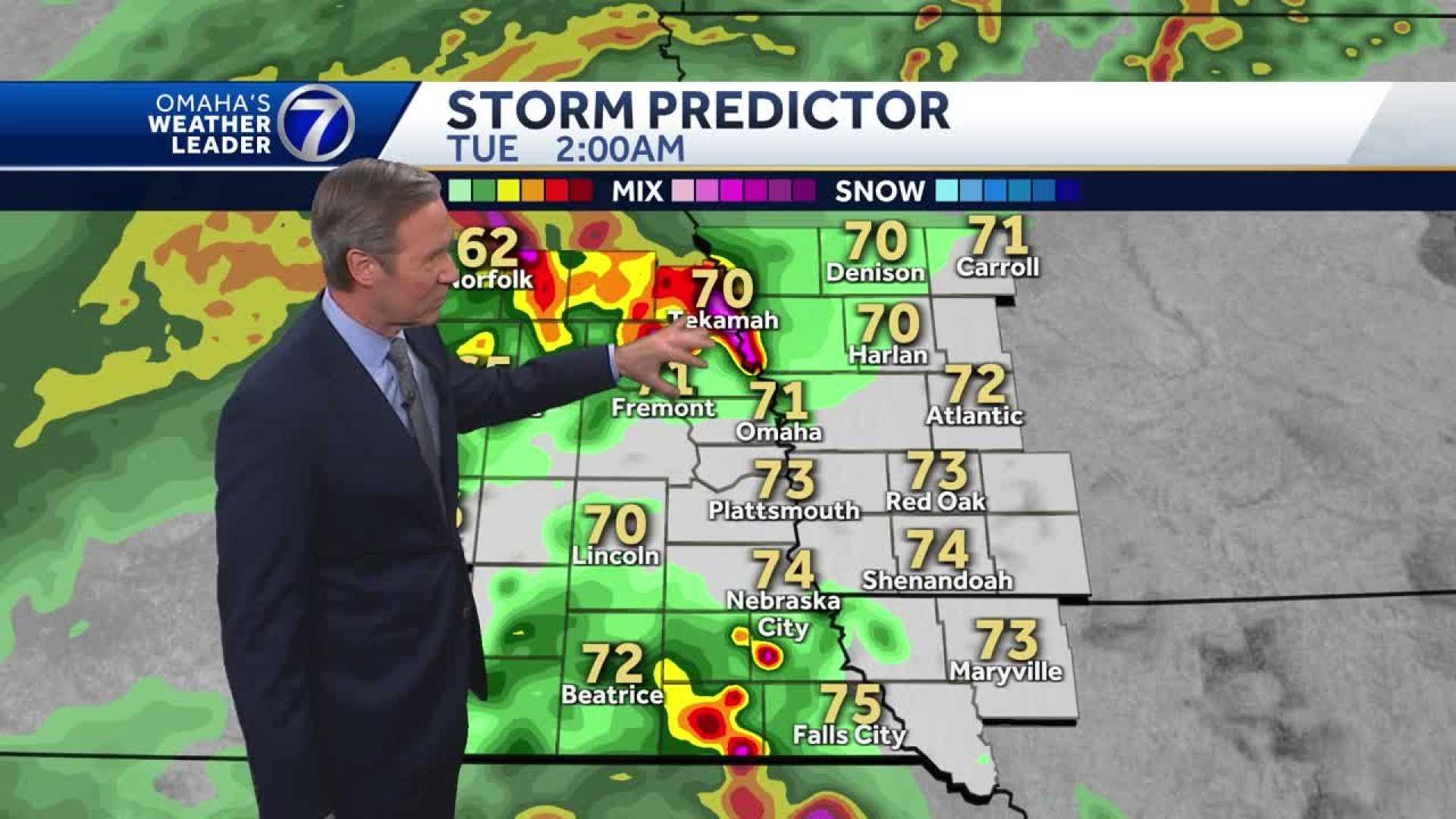
OMAHA, Neb. – A severe thunderstorm watch is in effect for parts of northeast and central Nebraska until 1 a.m. tonight, with heavy rain and gusty winds expected to hit the Omaha area.
The chance of storms tonight is attributed to a cold front moving through the region. Forecasters predict that storms will develop just west of Omaha, with stronger thunderstorms entering the viewing area around 1 a.m. Rainfall is anticipated throughout the night, with the possibility of thunderstorms continuing until early morning.
According to weather models, initial showers are expected to begin around 11 p.m. A more intense line of thunderstorms may be approaching the metro area by 2 a.m. A wet and chilly drive is anticipated tomorrow morning due to ongoing rain.
Weather experts noted that while the storms are expected to weaken as they move southeast, there remains a small threat for severe weather within the metro. The main concerns include large hail and damaging winds.
The temperature throughout the day Tuesday is forecasted to peak in the low 60s, significantly cooler than Monday’s highs near 90. The rainy weather is a welcome sight, as the area is currently over three inches below average rainfall for the season.
Although rain may subside later in the day, residents should prepare for scattered showers during the evening commute. By Wednesday, conditions are expected to clear up, bringing partly cloudy skies as temperatures rise to the mid-70s.
Additional rain chances return Thursday, and while rain may not affect every neighborhood, the wet weather is expected to provide some much-needed moisture.


