Severe Thunderstorms Expected in Mid-South This Weekend
MEMPHIS, Tenn. (WMC) – The Mid-South is bracing for a weekend of variable weather, including rain and thunderstorms. On Saturday, March 29, consistent rainfall is expected, particularly until 6 PM, with isolated thunderstorms also possible.
“We’re not anticipating strong-to-severe weather today, but outdoor plans should include an umbrella or rain jacket,” said Meteorologist Eric Brill.
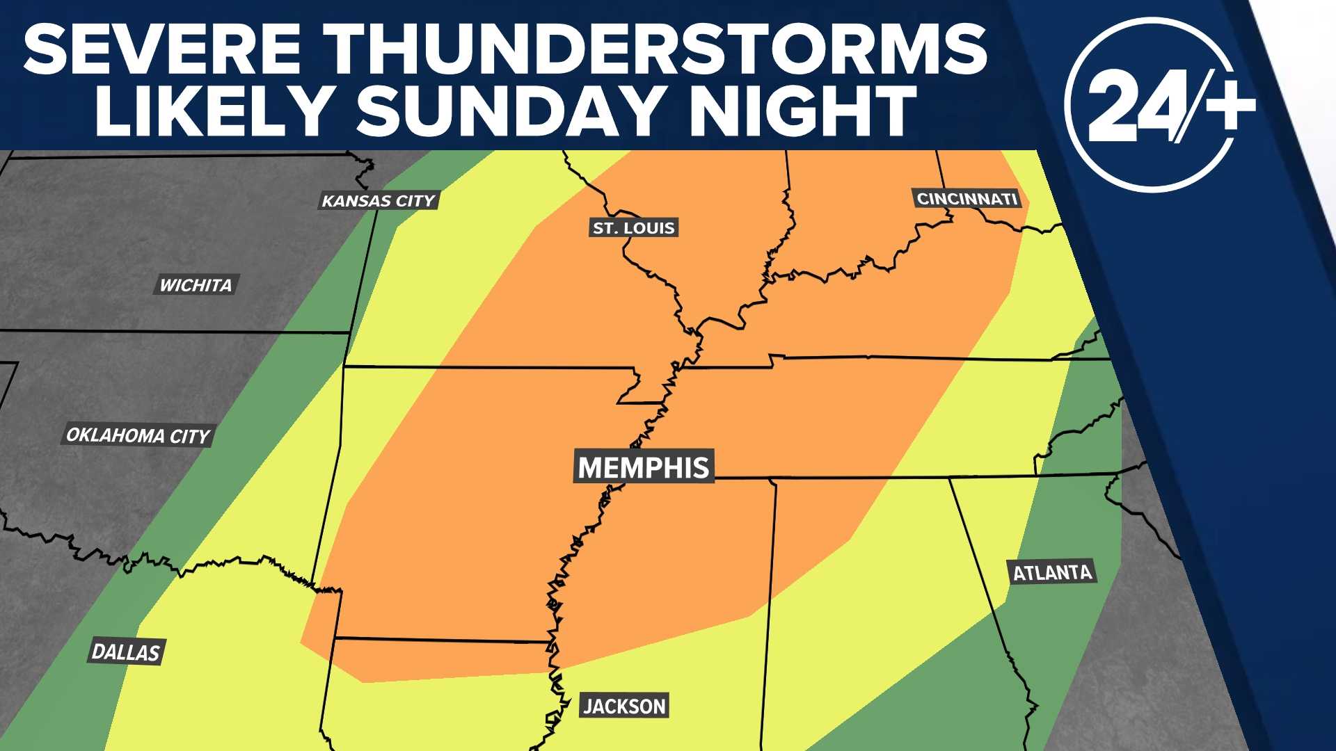
For Sunday, March 30, most of the day is forecasted to remain dry, with a line of thunderstorms expected to develop in Arkansas and move into the Mid-South by Sunday night. The storm line poses a risk from approximately 8 PM to 4 AM on Monday.
Before the main storm line arrives, more turbulent weather may develop between 4 PM and 8 PM, including the possibility of strong thunderstorms. Within these storms, the main threats are large hail, strong winds, and isolated tornadoes.
“Given that these storms will occur overnight, it’s crucial for residents to stay informed about potential developments,” Brill added.
Rain is anticipated to taper off by sunrise on Monday, April 1, leading to partly cloudy skies and cooler temperatures in the lower 60s. Pleasant weather is expected through Tuesday, with temperatures returning to the middle 70s. These days could be the best weather of the upcoming week.
However, another round of showers and thunderstorms is on the horizon for Wednesday, April 2, particularly during the afternoon and evening hours. Some of these storms may also be strong. The threat level for Wednesday has yet to be fully evaluated, as it is still several days away.
Looking further ahead, increased chances for rain will persist through the end of the work week and into the first weekend of April, with flooding being a significant concern from Wednesday through the following Monday.
The forecast for Saturday, March 29, calls for mostly cloudy skies with scattered showers and thunderstorms, high temperatures ranging from the upper 60s to the lower 70s. Saturday night will see lows in the middle 60s, mainly cloudy with isolated showers.
On Sunday, expect mostly cloudy skies with scattered thunderstorms, particularly after 3 PM, and high temperatures in the middle to lower 80s. Overnight into Monday morning, storms could persist until around 4 AM with lows in the middle 50s.
After the storms, Monday will be partly cloudy with highs in the lower to middle 60s. Prepare for more rain and thunderstorms as April begins, as the region faces a potentially wet start to the month.