News
Severe Weather Eases, But Flood Risks Remain in the Mid-South
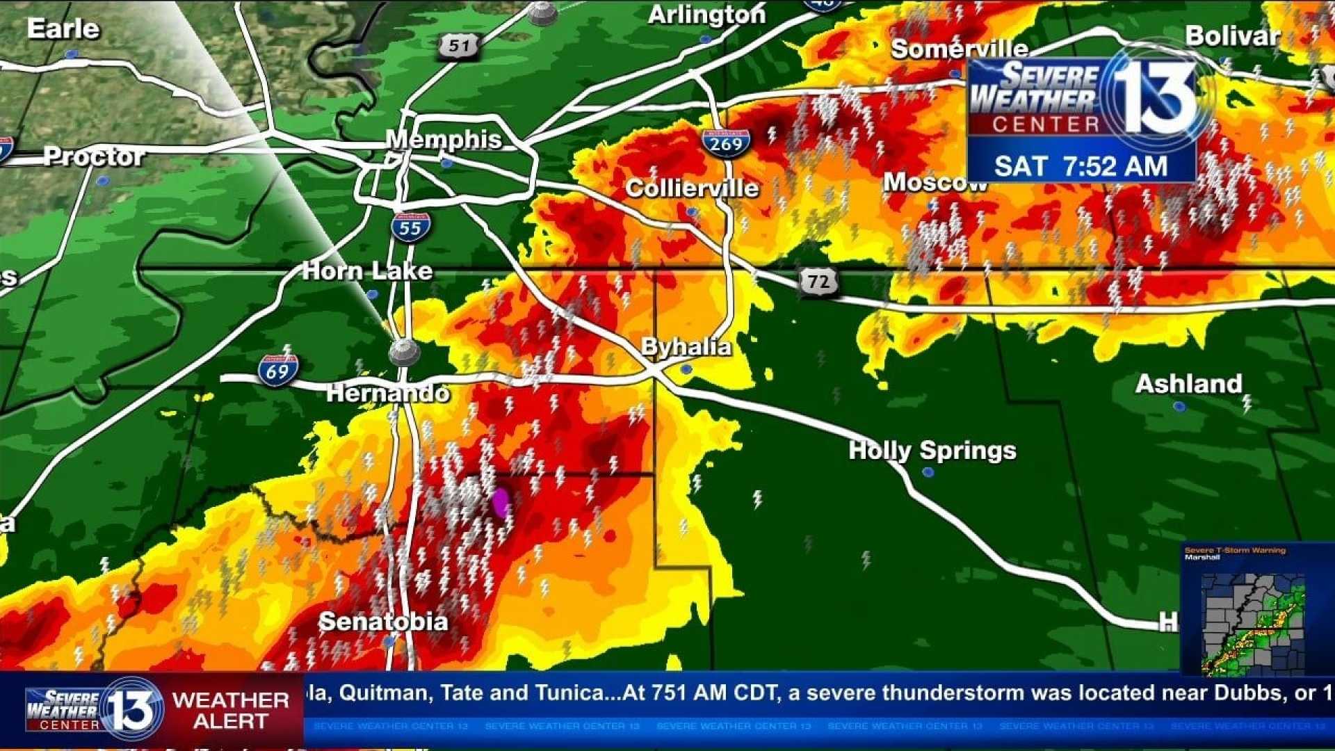
MEMPHIS, Tenn. – Severe weather has recently swept through the Mid-South, leaving behind a mix of clear skies and lingering flood risks. As of Saturday afternoon, March 9, there are no active thunderstorm or tornado warnings in the Memphis area, although several counties remain under severe weather alerts, particularly a Flood Watch.
n
The storms that raged earlier in the day produced significant rainfall and strong winds, affecting traffic conditions throughout the region. As of 2:30 PM Saturday, over 6,500 Memphis Light, Gas and Water customers were reported without power due to the severe weather’s impact.
n
The current alerts in place include: a Flood Watch for Benton, Tippah, Alcorn, Lafayette in Mississippi, and Hardeman and McNairy in Tennessee, effective through late tonight. The alerts highlight the risk of flash flooding in low-lying and poorly drained areas, as between 2 and 3 inches of rain have already fallen in some spots.
n
Additionally, flooding advisories are in effect for Benton, DeSoto, Marshall, and Tippah Counties in Mississippi, along with Hardeman, Haywood, Shelby, and Tipton counties in Tennessee until 4:45 PM. Residents in areas such as Bartlett, Southaven, Collierville, Germantown, Olive Branch, and many others are advised to prepare for potential flooding.
n
Looking ahead, the weather is expected to stabilize in the coming days. A transition to quieter weather is anticipated after tonight’s storms, with high pressure likely to deliver cooler temperatures and clear conditions on Sunday, when highs will reach near 58 degrees. Winds are expected from the northwest at 10-15 mph, creating a breezy atmosphere.
n
Early next week, temperatures are forecasted to rise. Monday will feature a high around 67 degrees under sunny skies, while Tuesday could reach the mid-70s, offering a taste of spring has to offer. However, residents should remain aware that a cold front may bring more rain and possible thunderstorms to the area midweek.
n
The Storm Prediction Center has indicated that the severe weather risk may escalate again next Saturday, March 15, with forecasts suggesting another system that could result in heavy rainfall and gusty winds across Alabama and surrounding states. Meteorologists warn that conditions could lead to severe thunderstorms due to the presence of sufficient moisture and wind shear.
n
For the latest updates and continued weather alerts, residents are encouraged to download the FOX13 Memphis app to stay informed about developing weather situations in their neighborhoods.


