News
Severe Weather Threat Predicted Across Multiple States Tuesday
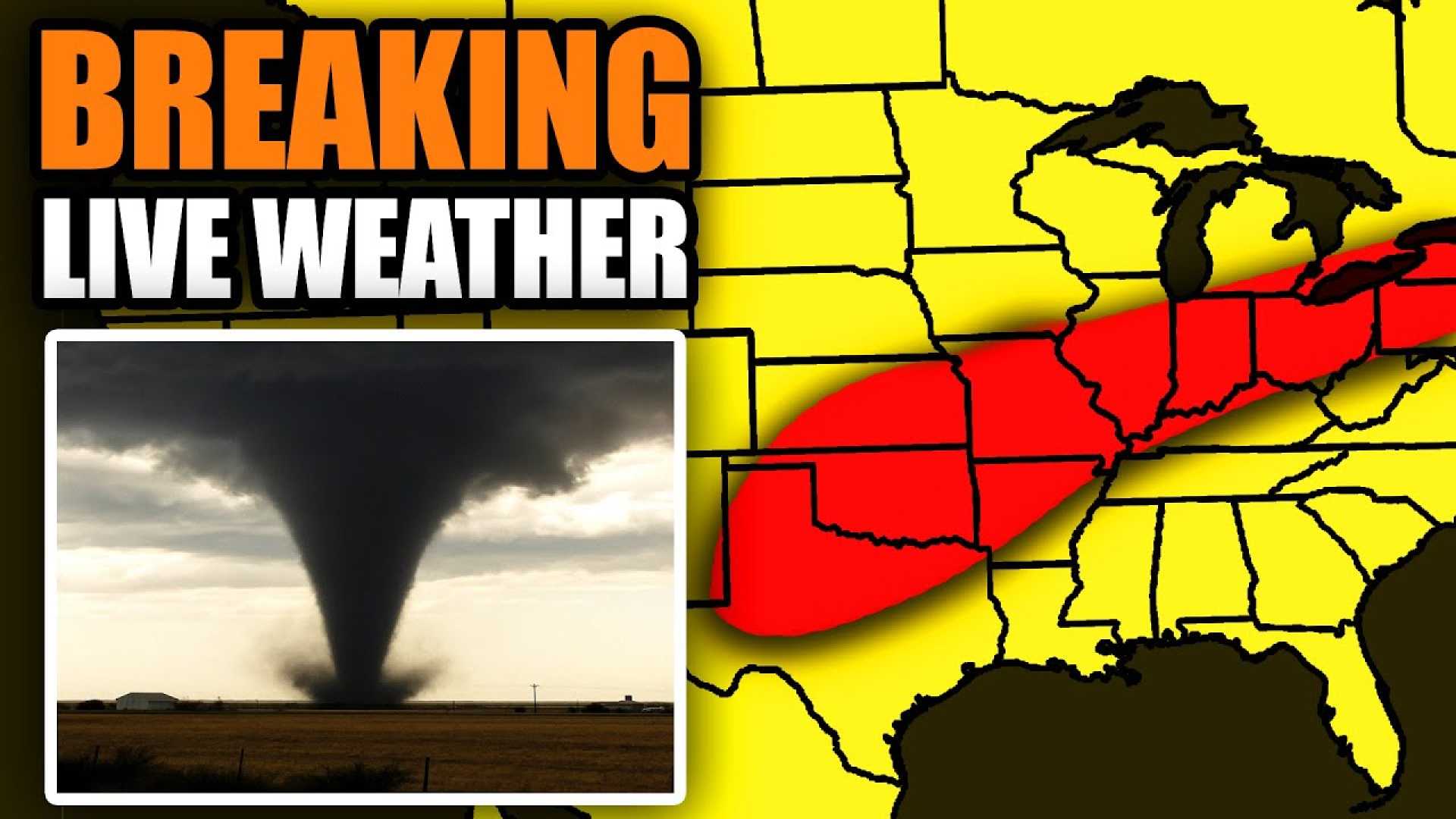
CINCINNATI, Ohio — A serious storm system is expected to impact parts of more than a dozen states on Tuesday, bringing multiple severe weather threats including gusty winds, large hail, and potential tornadoes. This weather event is affecting areas from the eastern Great Lakes to the Southern Plains.
Beginning Tuesday morning, scattered showers and storms are already affecting regions from northern Texas through Oklahoma and into the mid-Mississippi Valley. Predictions indicate that as the day progresses, wind damage, hail, and possibly tornadoes could develop, particularly in Ohio, Kentucky, New York, and western Pennsylvania.
The severe weather forecast includes cities like Cleveland, Cincinnati, Louisville, Buffalo, and Syracuse. The National Weather Service has labeled this system a Level 3 risk, indicating a significant potential for severe storms.
Tuesday’s storms are expected to develop in the early afternoon, with the highest activity anticipated between 1 p.m. and 3 p.m. in Greater Cincinnati. This severe weather is part of an ongoing pattern expected to last through Friday, with further rounds of rain and thunderstorms.
In addition to storm threats, there are flood watches issued from northern Texas to Oklahoma and parts of Missouri, where heavy rain is likely to produce flash flooding. Cities including Oklahoma City and Tulsa are under close watch as they have already experienced significant rainfall in recent days.
Residents are advised to prepare for possible severe weather by having multiple ways to receive alerts, such as weather radios and local news. The National Weather Service stresses the importance of safety, urging people not to drive through floodwaters.
As the storm system moves east, it may bring similar conditions to areas still recovering from recent storms. Some regions could see heavy rain, gusty winds, and hail throughout the day, with the storms clearing by nightfall.


