News
Severe Weather Threat Looms Over Southeast Louisiana This Saturday
BATON ROUGE, La. (AP) — Severe weather is poised to impact southeast Louisiana on Saturday, with forecasters warning of damaging winds, large hail, and the possibility of tornadoes as a powerful storm system approaches the area.
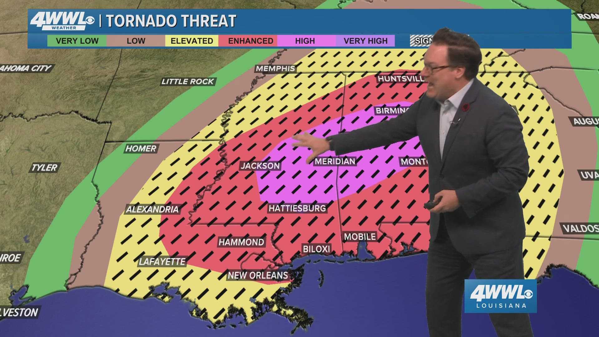
The National Weather Service has issued a Moderate Risk (level 4 of 5) for severe thunderstorms across significant portions of the Baton Rouge metro area, including East Baton Rouge, Livingston, and Ascension parishes. The risk extends into the surrounding parishes as well, with an Enhanced Risk (level 3 of 5) in effect for other southern and western regions.
“Scattered to numerous severe storms are anticipated to develop starting Saturday morning and may continue into the evening,” the NWS stated. “Conditions are ripe for these storms to become severe, particularly as storm activity begins to ramp up during the day.”
The timing for severe weather varies across the region. For the Baton Rouge metro area, the most severe thunderstorms are expected between 11 a.m. and 6 p.m. Meanwhile, the Northshore is looking at a similar risk from 9 a.m. to 8 p.m. River parishes, including areas like St. John the Baptist, Jefferson, and St. Charles, can expect threats from 10 a.m. to 3 p.m.
According to meteorologists, the main threats include damaging winds, capable of exceeding 110 mph, large hail over one inch in diameter, and the potential for strong tornadoes, including EF2 and stronger classifications. “This system is unusually deep for this region, creating a historic storm potential,” warned forecasters.
Earlier forecasts had indicated a lower risk for severe storms, but as the system has developed, the hazard levels have increased. The potential for an isolated tornado exists, particularly if thunderstorms manage to develop early. People are urged to stay informed via local weather updates and to prepare emergency plans, including designated safe locations in the event of a tornado warning.
“We want everyone to be prepared, but not panicked,” said WDSU meteorologist Raven Richard during a recent weather briefing. “We’re dedicated to keeping you informed and safe during this alert day.”
The impending storm system is expected to bring moisture and instability to the atmosphere, generating conditions conducive for severe storm development. Warm and humid air is already present in the region, with dew points anticipated to rise ahead of the storms.
As early as Friday evening, scattered showers were recorded in parts of southeast Louisiana, helping to set the stage for the storm system that forecasters will continue to monitor closely. By Sunday, conditions are expected to improve significantly, with clear skies and mild temperatures returning to the area.
Residents are encouraged to download the latest weather applications and tune in for updates as the day progresses, particularly as watches and warnings may be issued during the peak of the storm activity.


