News
Severe Weather Threat Looms Over South-Central U.S. Next Week
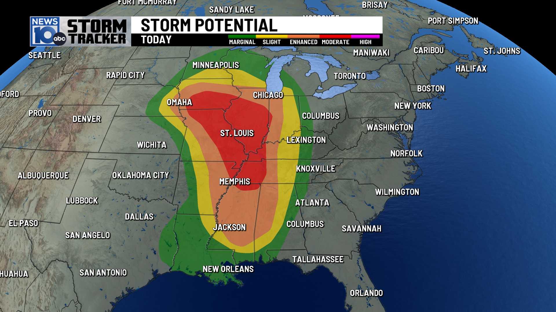
South-Central U.S. – A severe weather threat is set to impact the south-central United States on Monday, affecting seven million people from western New Mexico to Louisiana with flood watches in effect. On Sunday alone, 50 storm reports, including damaging winds and hail, were recorded across ten states.
According to meteorologists, the worst of the storms are expected on Monday in parts of far southeast New Mexico and across west and central Texas. Areas in these regions may experience damaging winds, large hail, and even tornadoes as slow-moving thunderstorms bring torrential rain.
“We’re expecting 1 to 2 inches of rain across the Texas Panhandle and New Mexico,” said a National Weather Service spokesperson. “However, localized totals could exceed 3 inches by Tuesday morning.”
The forecast also warns that strong to severe storms might develop along the East Coast following recent weekend rains. Areas from the Mid-Atlantic to northeastern North Carolina, including the New York City metro area and parts of Connecticut, are under a slight risk for flash flooding.
In the southeast, particularly the Florida East Coast, isolated severe storms could create damaging winds and possible tornadoes. As the system progresses, it is expected to deliver another round of thunderstorms to the central U.S. on Tuesday, impacting over 17 million people.
“The Deep South and eastern Texas may face the highest threat of flash flooding,” a weather expert explained. “We’re predicting up to 6 inches of rain along the lower Mississippi River, with other regions experiencing 1 to 3 inches.”
In South Mississippi, WLOX First Alert Weather reported that a return of showers and storms is imminent, starting Tuesday afternoon. “While not everyone will experience rain on Monday, we recommend being prepared for gusty winds and potential heavy rain,” the team noted.
The severe weather risk escalates on Tuesday, reaching level 2 of 5 according to the National Weather Service. “Significant hail is a major concern, especially in the southern areas,” they added, warning residents of possible hail exceeding the size of golf balls.
The flash flood risk is also designated at level 2, indicating a 15% chance of flash flooding in many neighborhoods. A Flood Watch has been issued for Navarro, Limestone, Freestone, Robertson, and Leon Counties as heavy rain is anticipated.
“By Friday, many areas in South Mississippi could receive between three to six inches of rain,” WLOX stated. “Locally higher amounts of six to eight inches are also possible in areas experiencing repeated storms.”
The system’s specifics will unfold as the week progresses. Residents are encouraged to download the WLOX First Alert Weather App for the latest updates.


