Severe Winter Storm Hits Eastern Kentucky, North Carolina
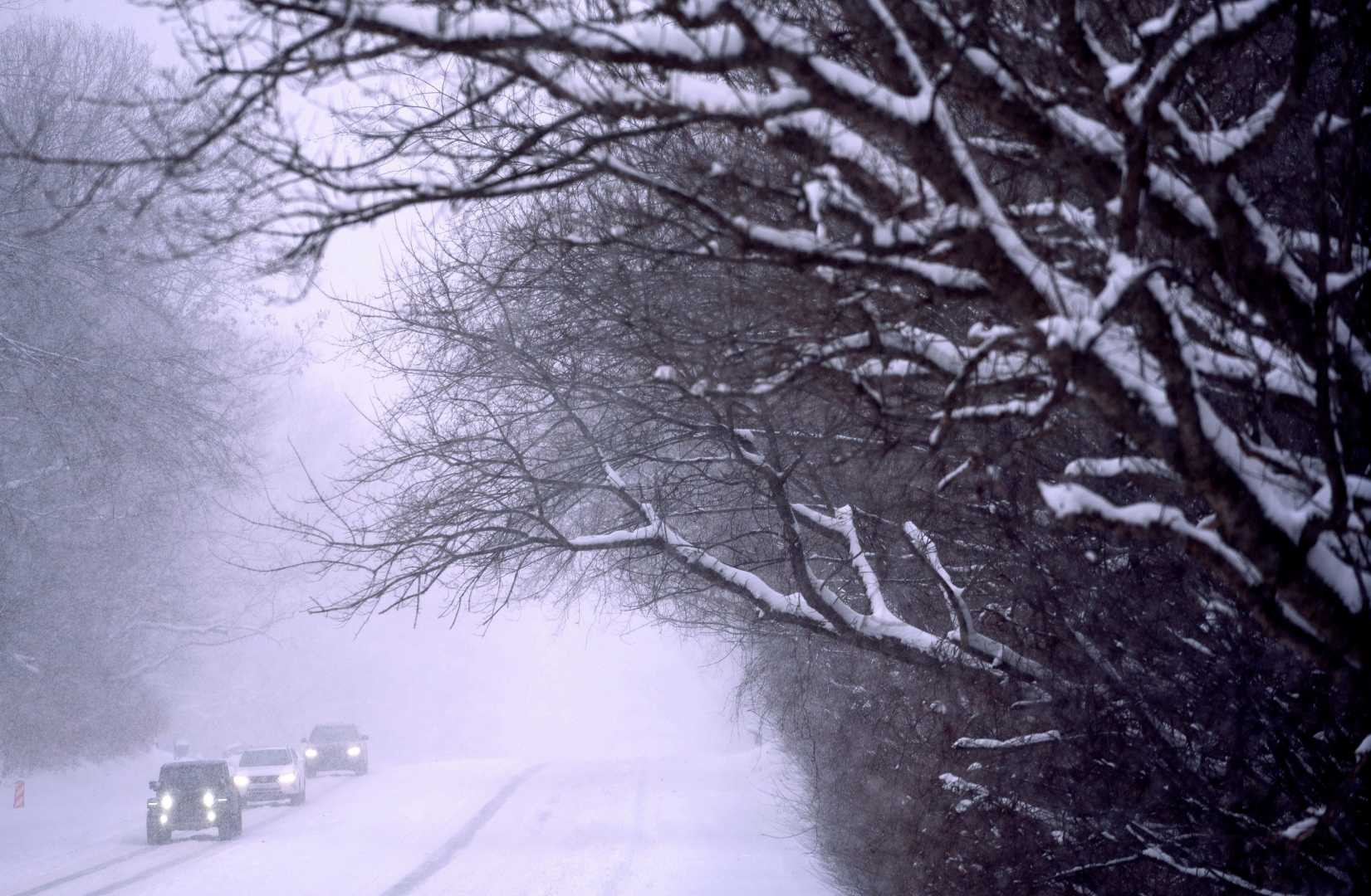
HAZARD, Ky. (WYMT) – A severe winter storm has swept through Eastern Kentucky and portions of North Carolina, bringing heavy snow and sleet, coupled with dangerously low temperatures and hazardous road conditions. The storm began early Wednesday morning and is forecast to last until Thursday.
Residents in Kentucky have reported significant flooding earlier in the week due to heavy rain, but the latest snowfall has compounded the difficulties. The National Weather Service warns that the snow and sleet could lead to accumulations of three to six inches across Northern Carolina, with some areas facing totals nearing ten inches.
“Travel conditions will be extremely dangerous due to icy roads and significant snow accumulation,” said a spokesperson for the North Carolina Department of Transportation. “Motorists should avoid driving unless absolutely necessary and stay updated on road conditions.”
As temperatures have dropped to the low 30s, many roads are becoming slick, increasing the risk of accidents. The weather service advises individuals traveling in the area to exercise extreme caution, as wind chill factors are causing feels-like temperatures to dip into the teens.
In addition to snow, areas affected by the winter storm are also facing the potential for ice accumulation of up to three-tenths of an inch, which could result in power outages and difficulties for first responders and utility workers trying to clear the roads.
The Winter Storm Warning for North Carolina counties will remain in effect from 7 a.m. today until 10 a.m. tomorrow. A concurrent Winter Weather Advisory is also in place for several counties, including Johnston, Moore, and Darham, warning citizens of mixed precipitation expected today.
The weather service expects the most severe conditions to hit during the evening commute on Wednesday, with deteriorating conditions and limited visibility due to blowing snow. This creates a high likelihood of travel disruptions and hazardous commutes.
Further complicating matters, Wednesday night lows are expected to reach the mid-teens, which will cause any standing water from melting snow and rain to freeze, complicating road conditions even further. Residents are urged to stay indoors until conditions improve.
This winter storm follows a prolonged period of unpredictable weather, with temperatures swinging drastically. Following the storm, forecasters predict a warm-up beginning Friday, with highs expected to reach the 30s by then.
Citizens are encouraged to stay tuned to local weather updates and alerts via apps and broadcasts for the latest information.
Copyright © 2025 WYMT. All rights reserved.