March Storm Threatens Tornadoes, Blizzard Conditions Across Eastern U.S.
WASHINGTON, D.C. – A powerful storm system is sweeping across the eastern United States, bringing with it a myriad of hazardous weather conditions including blizzards, tornadoes, and severe thunderstorms. The storm, which started developing over the Rockies, is expected to intensify and affect millions this week.
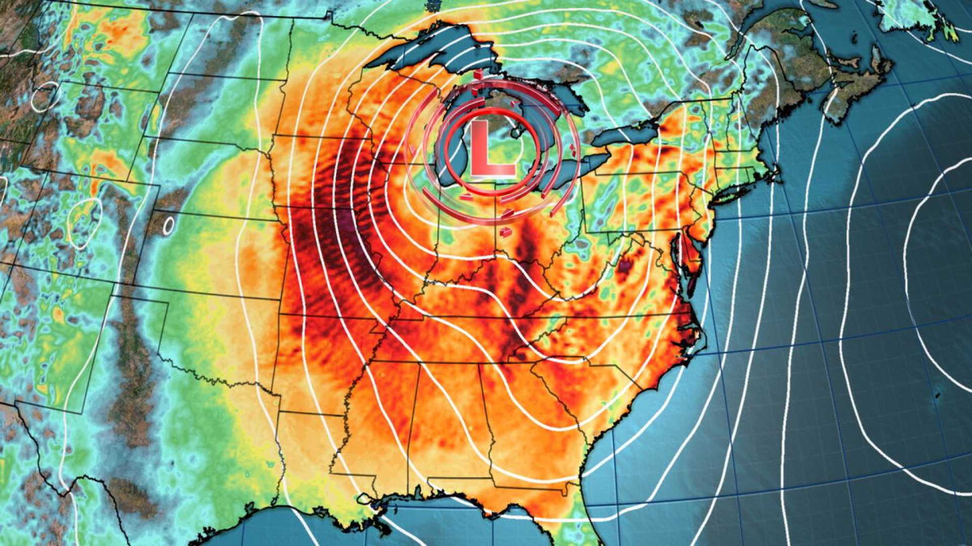
Early indications of the storm’s strength were noted Monday as it began to build momentum, impacting the central U.S. with extremely strong winds and a significant risk of fire weather. Meteorologists from the Weather Prediction Center warn that this storm could reach near record intensity for March as it moves eastward.
According to the National Weather Service, wind gusts could exceed 60 mph in the Rockies and Plains, which may disrupt power and lead to localized damages. “These winds are potent enough on their own, but additional risks will escalate alongside them,” said a spokesperson from the National Weather Service.
Conditions are particularly dire in eastern New Mexico and western Texas, where a level 3 of 3 fire risk has been issued due to very dry conditions combined with high winds. Fires could erupt quickly, turning into uncontrollable infernos under these circumstances.
As the day turns to night, thunderstorms are forecasted to sweep from Texas to Kansas, posing threats of damaging winds, hail, and an increased risk of tornadoes. The first line of storms is expected to hit the Dallas-Fort Worth area by sunrise, with forecasters predicting further intensification as it moves across the Mississippi Valley later in the day.
The Storm Prediction Center has issued a level 3 of 5 risk of severe thunderstorms for large portions of Louisiana, Arkansas, and Mississippi, signaling that the potential for strong tornadoes is significant. “EF2 or higher tornadoes are possible in the area,” a representative from the Jackson, Mississippi, office said.
In New Orleans, Mardi Gras celebrations have felt the impact of the impending storm, leading to the cancellation of numerous parades scheduled for Tuesday. Meanwhile, those set to proceed have been rescheduled for earlier times to evade the dangerous weather.
As the storm system progresses into the Southeast, heavy rain and high winds are anticipated. Blizzard warnings extend from the Rockies through Nebraska and South Dakota, creating a concerning mix of heavy snowfall and wind gusts over 60 mph, leading to potential whiteout conditions.
The National Weather Service cautioned travelers, stating, “Whiteout conditions are expected and will make travel treacherous and potentially life-threatening.”
More than 24 million people across the eastern states, including Georgia through Pennsylvania and as far north as New Jersey, are currently under a level 2 of 5 risk of severe thunderstorms. “We anticipate that significant impacts on air travel will result, particularly in major hubs such as Chicago and the New York City area,” warned weather experts.
Although the precipitation from this storm is expected to taper off by Thursday, brisk winds are likely to linger, raising further concerns for power outages across more than a dozen states.