News
Thunderstorms Exit Baltimore Region; Clear Skies Expected Friday
BALTIMORE, MD — Thunderstorms and rain are moving out of the Baltimore area, with the threat of severe weather diminishing as storms are expected to end by midnight.
According to the latest updates, a line of thunderstorms moved into the Baltimore metro area on Thursday evening. Residents were advised to stay weather-aware due to a small risk of severe winds and a brief tornado.
A coastal flood advisory was also issued for the shoreline of Anne Arundel County until midnight Thursday.
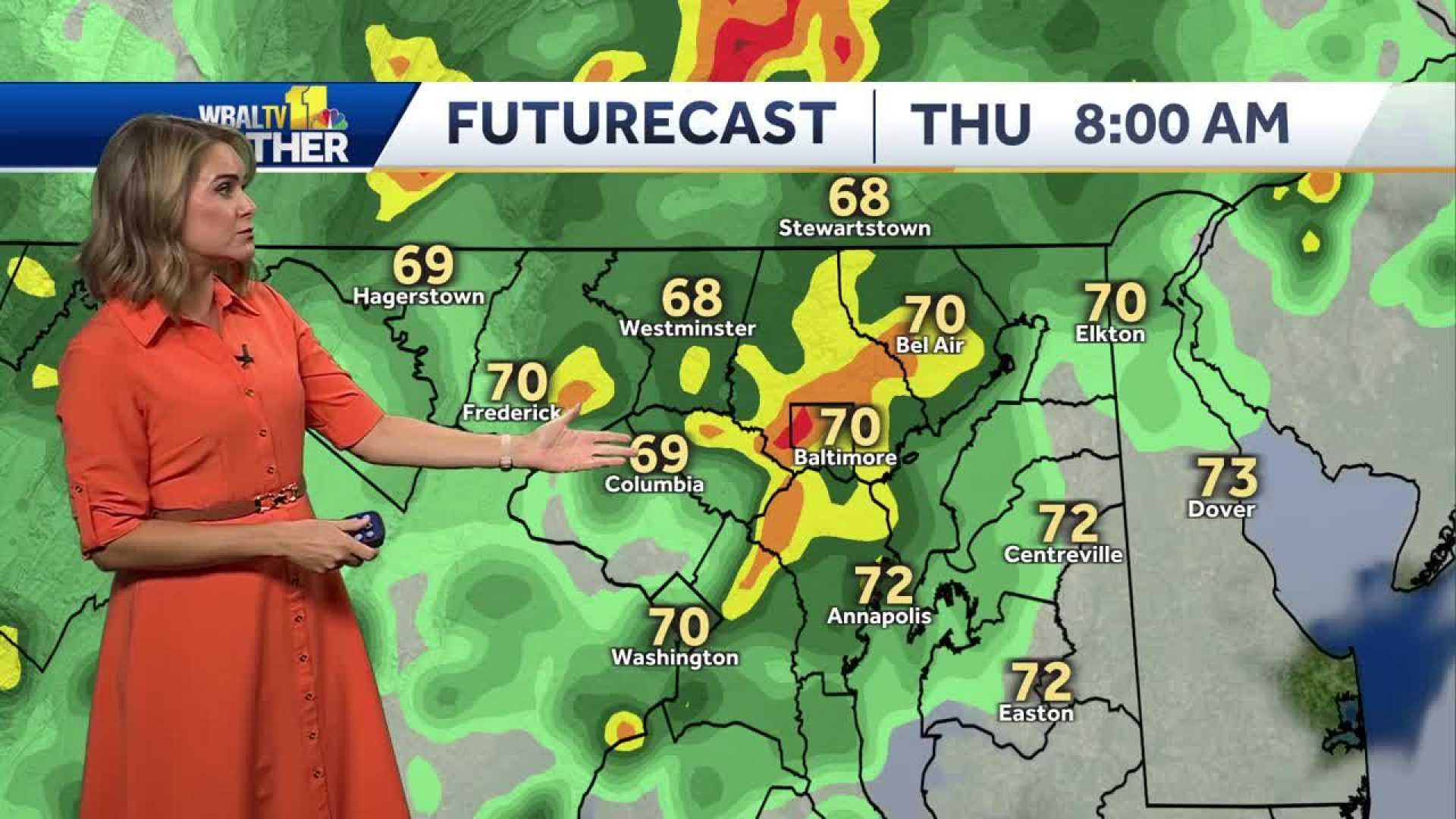
Meteorologist Alena Lee reported that while rain and patchy fog were anticipated on Thursday morning, showers should taper off by midday. Isolated thunderstorms could occur in the evening, particularly between 6 p.m. and 11 p.m., with the potential for damaging winds and a low risk of tornadoes.
“If the storms from the mountains hold together, they could reach Baltimore between 4:30 and 8 p.m.,” Lee said. She noted that while New Jersey faces a greater tornado risk, Maryland remains under watch.
A severe thunderstorm warning was issued for parts of Montgomery County as the storm moved eastward at approximately 25 mph towards Baltimore.
As the thunderstorms began to taper off around midnight, clearer skies were forecasted for Friday, providing a break from the weather disturbances. Temperatures are expected to remain warm and humid, with a high around 81°F.
Residents are reminded that while power outages may occur due to storm damage, they should report outages to Baltimore Gas and Electric (BGE) through their website, mobile app, or by calling 877-778-2222. Caution is also urged around fallen wires.
Looking ahead, drier weather is expected to return on Friday. However, another round of rain is predicted for Saturday, which may last into the evening before giving way to improved conditions by Sunday.


