News
Tornado Spotted as Severe Storms Strike Central U.S.
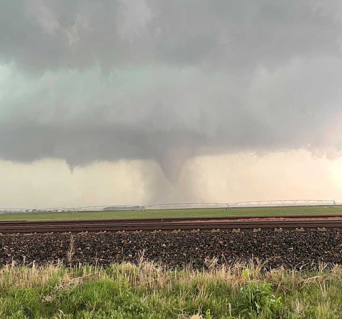
OKLAHOMA CITY, Okla. — A tornado was spotted near North Bend, Nebraska, on Monday evening as severe storms swept across the Central U.S. The National Weather Service (NWS) issued multiple tornado watches and warnings as a significant weather threat loomed.
Severe thunderstorms developed across vast regions, prompting a tornado watch for North Texas, Iowa, Nebraska, Kansas, and Missouri until 9 p.m. CT. Areas of Arkansas, Oklahoma, and northeast Texas face continued tornado watches into Tuesday morning, affecting major cities such as Kansas City, Oklahoma City, and Omaha.
As conditions worsened, over 100,000 residents in Kansas, Missouri, Texas, and Oklahoma experienced power outages due to downed lines and damage caused by severe weather. In Oklahoma, large hail and several tornado reports emerged, with damage being assessed.
At about 7:30 p.m. CT, radar detected a debris signature indicating a tornado hit near Greenland, Arkansas, moving into Fayetteville. FOX Weather Meteorologist Steve Bender expressed concern, noting, “Wow, that is not a good sign. We have a very apparent debris ball.”
The tornado threat extended across the Plains, with meteorologists warning of potential for strong, long-tracked tornadoes and damaging winds exceeding 70 mph. Reports indicate that some supercell storms produced baseball-sized hail.
As the severe weather system advanced, significant rainfall led to flash flooding risks, particularly in the Ozarks, where previous storms had saturated the ground. An estimated 4 to 7 inches of rain had already fallen in parts of southeast Kansas and southwest Missouri.
Authorities urged residents to prepare for ongoing severe weather overnight Monday and through Tuesday. Local emergency services encouraged the public to monitor alerts and take cover as necessary.
As the storms progressed, the weather threat remained high across several states, creating an urgent call for safety and readiness in impacted communities.
The severe storm threat is expected to evolve into Tuesday with continued warnings in place, subject to real-time updates from the NWS.


