News
Tornado Watch Issued as Severe Storms Approach Cincinnati Area
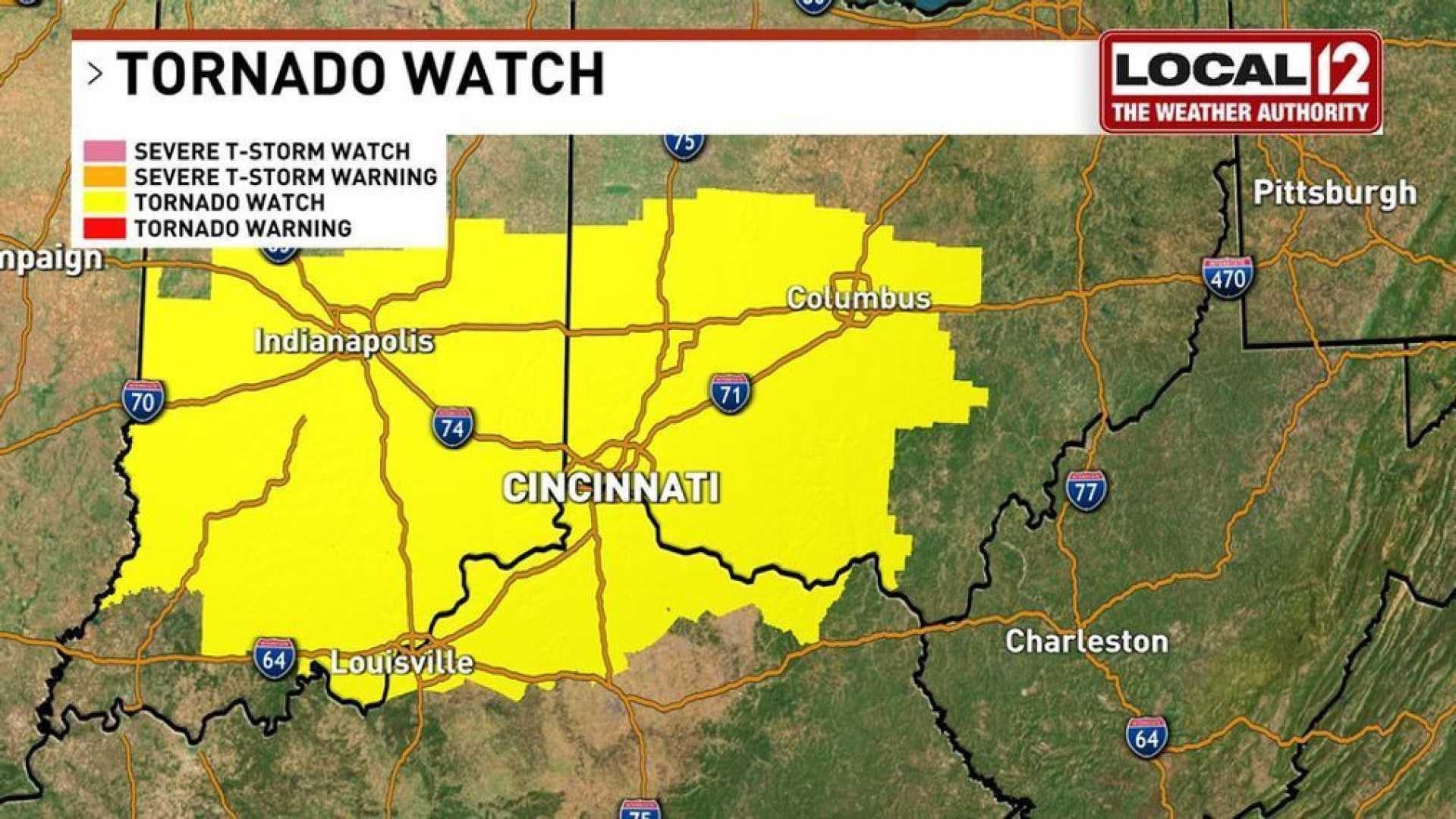
CINCINNATI, Ohio — A Tornado Watch is in effect for the Cincinnati region as a powerful storm system moves into the area, bringing the potential for severe weather, including damaging winds and heavy rain.
The watch, in effect until 10 a.m. Saturday, March 15, includes parts of Hamilton County, Dearborn County, and surrounding areas. Meteorologists have reported a severe thunderstorm warning for parts of Indiana, with fast-moving storms expected to bring wind gusts of up to 60 mph and nickel-sized hail as they approach the Tri-State area.
According to the National Weather Service, the severe thunderstorms are currently traveling at speeds of 55 to 60 mph, affecting areas like Ripley County and northern Kentucky. The storms are forecasted to reach Osgood by just before 6 a.m. and then quickly spread towards Cincinnati.
The storm system is predicted to produce heavy rainfall, with total accumulations of 1 to 2 inches possible, leading to potential flooding in certain areas. The risk for flooding has prompted a Flood Watch in northern Kentucky extending through Sunday morning.
As the day progresses, the severe weather threat is expected to continue with rounds of rain and wind. Meteorologist Erica of WKRC noted, “The main threat today will be damaging winds and isolated tornadoes.”
Residents have been advised to remain alert as scattered thunderstorms will persist into the afternoon, with the possibility of heavier rainfall arriving from the south later in the day.
“We are looking at significant issues with flooding,” said Erica, emphasizing the need for caution, especially in areas prone to inundation. “With conditions conducive for severe storms, we could see strong wind gusts and potentially severe weather lingering into the evening.”
The National Weather Service has also issued a Wind Advisory that remains in effect until 8 p.m. Saturday, warning of wind gusts that could reach 40 mph outside of thunderstorms.
This severe weather event marks a continuation of hazardous weather across the Midwest, where tornado watches have been reported in multiple states. Residents are urged to stay informed through local weather updates and to maintain safety precautions as potentially dangerous storms approach.
The Cincinnati region is expected to see a decrease in storm activity by late morning, with a resumption of scattered showers throughout the afternoon and evening, leading into a quiet start to the work week on Monday.


