News
Wet Snow Forecasted to Sweep Across Louisville Tonight
LOUISVILLE, Ky. — Chief meteorologist Jay Cardosi has announced that wet snow is expected to impact the Louisville area late tonight into tomorrow morning, with several inches of accumulation possible across the region.
Currently, the weather is calm with partly cloudy skies and a temperature of 43 degrees. However, as the evening progresses, conditions are expected to deteriorate. “We’re looking at no problems for the first half of the night, but heavy precipitation is expected to move in around 3 a.m.,” Cardosi said.
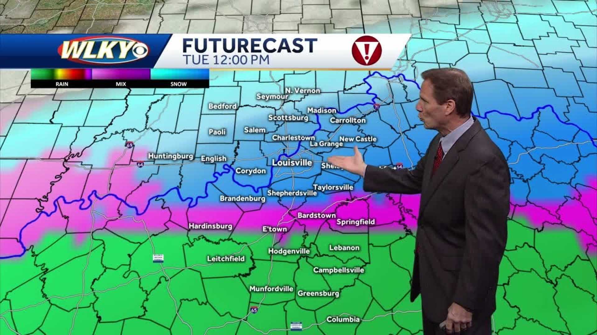
The winter weather system is forecasted to bring a mix of rain and wet snow, with rain likely dominating in southern Kentucky and wet snow accumulating in areas north of the Parkway, including E-Town, Bardstown, and Louisville.
A winter storm warning is in effect for Floyd County, Harrison County, Jefferson County, Oldham County, and adjacent areas until tomorrow evening. Cardosi noted that the forecast suggests snowfall rates may yield 2 to 5 inches of wet snow in the warning zones. He mentioned, “We expect several inches of wet snow before any transition to drizzle later in the afternoon.”
The precipitation pattern will see light to moderate snow impacting Louisville and the surrounding areas early tomorrow morning, particularly from Shepherdsville through the city and further north and east. Meanwhile, those in southern communities may experience primarily rain.
As the storm system weakens, the snowfall is expected to diminish significantly. “By tomorrow evening, as the main energy pulls away, we should see a quick end to the snowfall, and conditions will begin to normalize,” Cardosi explained.
The chief meteorologist also addressed road conditions once the storm subsides, indicating that roads should remain manageable, provided snowfall rates decrease quickly. Temperatures are expected to stay significantly warmer than recent systems, with a high of 36 degrees tomorrow.
As the week progresses, temperatures are predicted to rise above freezing, helping melt any accumulated snow by Wednesday and Thursday. Cardosi encourages residents to prepare for the potential interest of severe weather as the winter pattern continues.


