News
Winter Storm Hits Kentucky and West Virginia, Snow Accumulation Expected
LOUISVILLE, Ky. — A winter storm is bringing significant snow across Kentucky and West Virginia beginning Tuesday evening, with the heaviest accumulation expected overnight into Wednesday morning.
According to meteorologist Jay Cardosi, residents in the southern regions of both states should prepare for 1 to 5 inches of snow. As the storm system progresses, areas south of Interstate 64 are under a winter storm warning, anticipating the majority of snowfall, while northern regions remain under a winter weather advisory.
“We’re expecting two bouts of wintry weather,” Cardosi said. “Tonight through the overnight hours, the snow will be light due to battling dry air, but it will pick up again tomorrow evening.” Currently, temperatures in Louisville hover around 19 degrees with 74% humidity.
The initial snowfall began lightly Tuesday evening, covering sections of the road in areas like Elizabethtown. Forecasts indicate that as the snow pushes northward, locations such as E-Town and Bardstown could see particularly heavy accumulations, potentially reaching or exceeding 4 inches overnight.
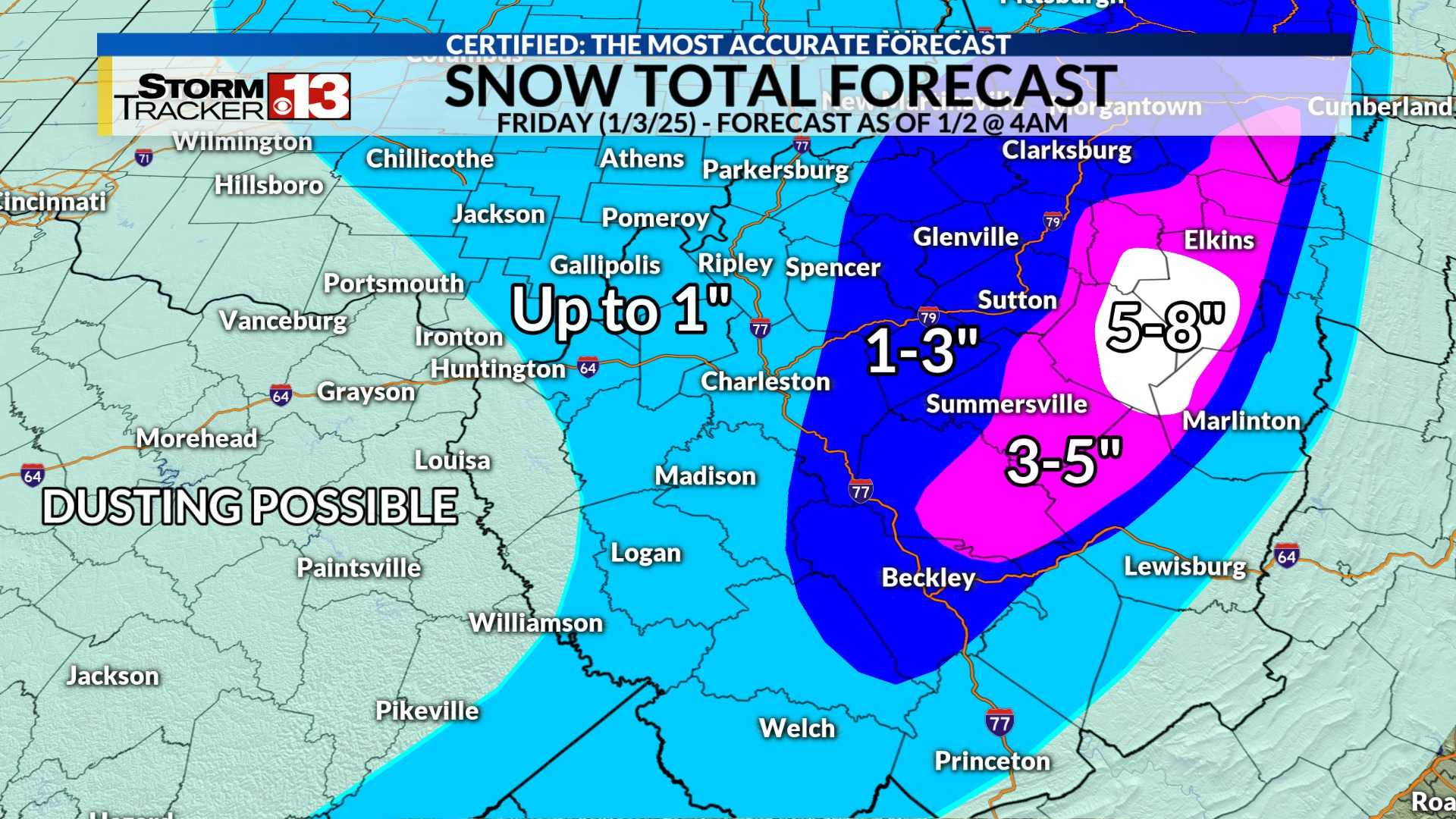
For the Huntington and Charleston regions in West Virginia, 1 to 2 inches of snow is expected by 7 a.m. Wednesday, with reports indicating that slick travel conditions could pose risks for commuters. “Some schools have already closed or delayed classes due to the anticipated snow,” said a local weather service representative.
The National Weather Service predicts a sharp northern cutoff in snowfall amounts along Route 33 and Route 50, where little to no snow is likely. However, the southern coalfields may see accumulations reaching up to 8 inches by Wednesday evening.
Cardosi also noted that after the storm passes, cold air will linger in the area, maintaining low temperatures that can feel much colder due to wind chill factors. The transition from snow to cold conditions is expected to impact travel across Kentucky and West Virginia into Friday.
“We are putting residents on alert for hazardous travel conditions as snow will blanket roads,” Cardosi advised. “This storm will be impactful, leading to potential school closures and travel delays.”
The winter storm is expected to taper off by Thursday afternoon, with high pressure moving in, bringing clearer skies and gradually warming temperatures by next week.


