News
Winter Storm Watch Issued for North Carolina and Virginia

WINSTON-SALEM, N.C. — A Winter Storm Watch has been issued for numerous counties in North Carolina and Virginia, set to begin Wednesday morning and continuing through Thursday morning. Significant snowfall and winter weather impacts are expected, prompting local weather officials to caution residents about potential travel hazards.
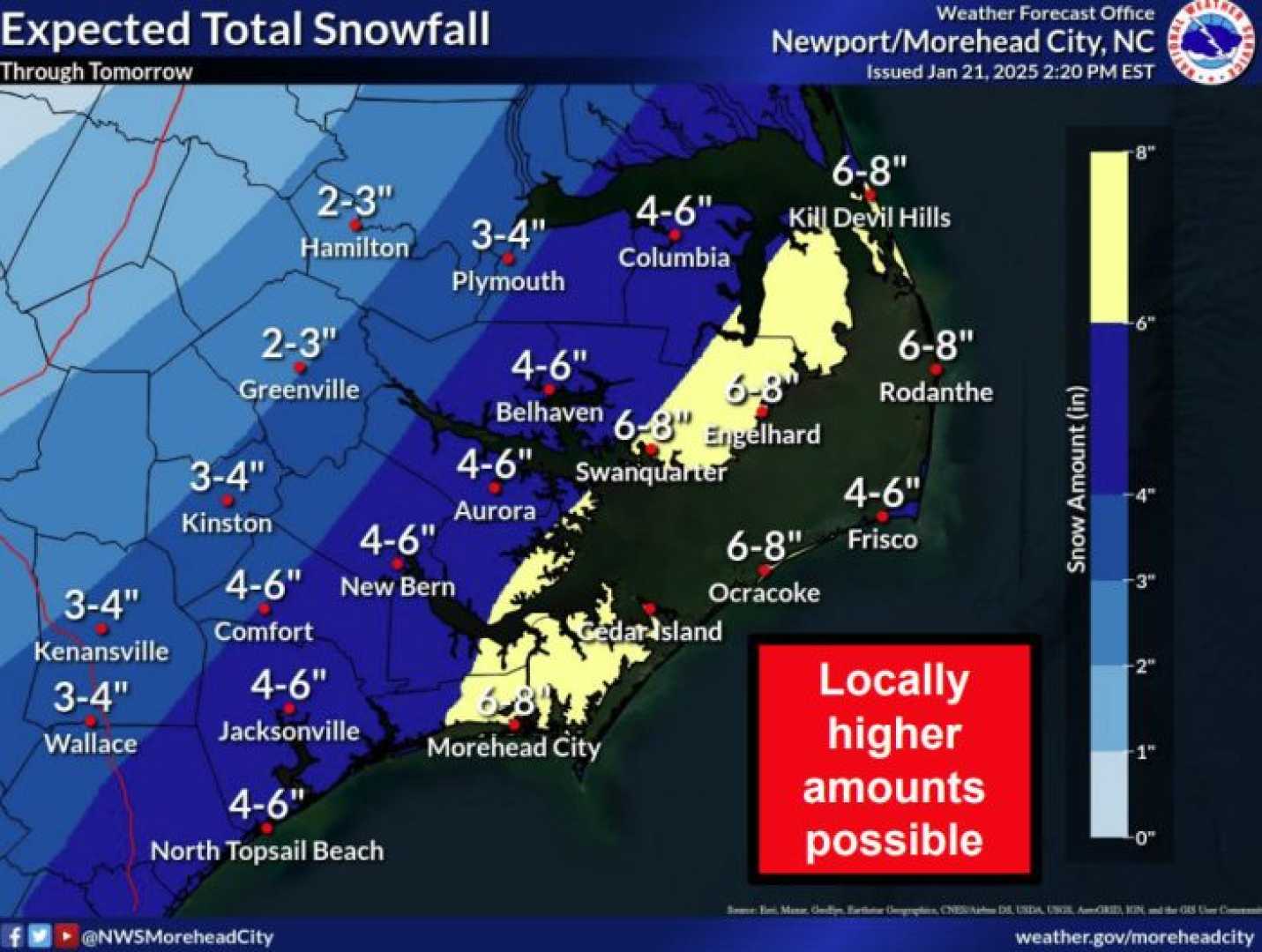
The alert affects counties including Alamance, Forsyth, Guilford, Davidson, Randolph, Stokes, Rockingham, and Caswell. Snow and sleet accumulations of 1 to 3 inches are anticipated in the watch area, with higher totals potentially occurring in the eastern regions, particularly near the Virginia border.
“This storm is part of a series of winter events we’ve seen this February,” said meteorologist Brian Slocum of WXII 12 News. “The layering of cold Canadian air over warmer systems will lead to a mix of snow, sleet, and possibly freezing rain.”
Last week, two days of freezing rain across North Carolina resulted in significant ice accumulation, leaving thousands without power before a strong cold front moved through the region, exacerbating the situation by downing trees and power lines.
The incoming system is characterized by dry, very cold air descending from Canada, which will interact with an area of low pressure that is expected to develop along the Gulf Coast. As this moisture moves north into the Ohio Valley and the Carolinas, wintry precipitation will begin.
Timing for the storm suggests that precipitation will start regions-wide on Wednesday morning or early afternoon, primarily as snow. A secondary wave of wintry weather might follow on Thursday.
Weather models indicate shifting dynamics around the storm’s evolution, with uncertainty about the primary low’s exact track potentially impacting snow and ice accumulations.
“Confidence is growing in terms of snow totals, especially for areas north of Interstate 40,” Slocum explained. “The best possibility for measurable snow remains there, while mixed precipitation is more likely in southeastern Piedmont areas.”
The National Weather Service has highlighted the importance of tracking development closely. As the storm approaches, residents should prepare for hazardous travel conditions, increased school closures, and lingering impacts extending into the weekend.
Freezing rain and ice accumulations are expected to be minimal, with a light glaze of less than 0.1 inches forecasted. However, a more severe ice event may develop in the eastern parts of North Carolina if snowfall does not materialize as projected.
“We’ll be monitoring several key factors as we get closer to Wednesday,” Slocum said. “The storm’s track and moisture availability will be crucial to determining final accumulations, so we encourage everyone to stay informed through reliable weather reports.”


