News
Tornado Watches Issued as Severe Weather Threatens Oklahoma City
OKLAHOMA CITY – A tornado watch has been issued for numerous counties in central and eastern Oklahoma as strong storms are forecasted for Monday, May 19, 2025. Meteorologists warn that this could be the biggest chance of severe weather for the state this season.
The watch is in effect until 7 p.m. and covers several counties including Adair, Cherokee, Choctaw, Creek, Delaware, Haskell, Muskogee, Tulsa, and Wagoner, among others. The conditions are ripe for dangerous storms that may produce sizable hail and tornadoes.
According to Chief Meteorologist Damon Lane, storms are expected to develop along the dryline after 1 p.m., moving eastward across the state with peak intensity likely impacting the Oklahoma City metro area between 3 p.m. and 6 p.m. High winds aloft, reaching up to 140 mph, could further enhance the chance of severe weather.
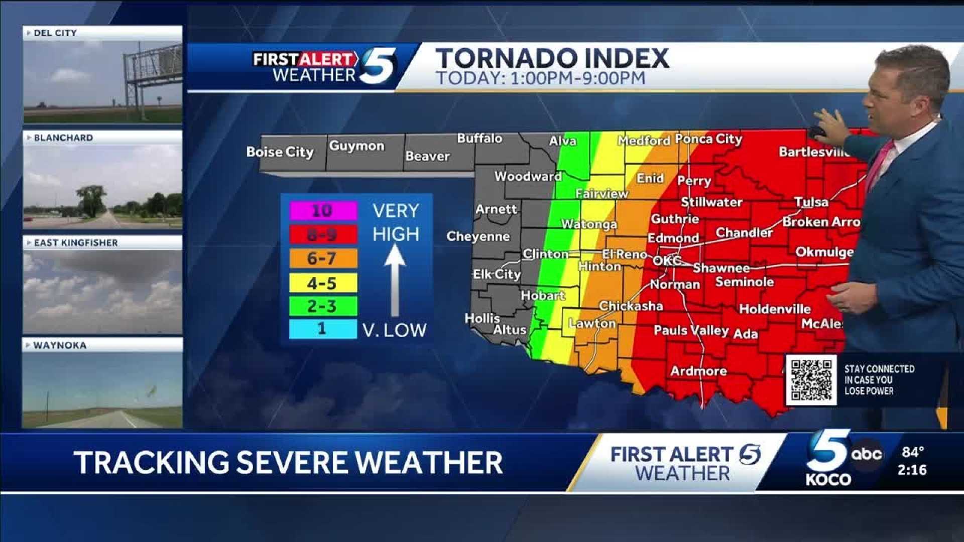
The National Weather Service has indicated a tornado index of 8 out of 10 for the central Oklahoma region, raising red flags for potentially strong or long-tracked tornadoes. In addition to tornadoes, meteorologists warn of destructive hail, with reports of softball-sized stones possible.
As severe storms approached, the University of Oklahoma adjusted its schedule to close early in anticipation of hazardous conditions. Meanwhile, multiple schools in the Oklahoma City area have canceled after-school activities and postponed graduation ceremonies due to the severe weather threat.
Residents are urged to monitor updates closely and take necessary precautions. If a tornado warning is issued, individuals should seek shelter immediately in a sturdy building’s lowest, interior area, away from windows.
By 5 p.m., radar indicated severe thunderstorms producing hail and potential tornadic activity were moving toward Stillwater, while widespread power outages affected thousands in the Oklahoma City area. As the day progresses, storm trackers advise staying alert for rapidly changing weather conditions.


