News
Heavy Rain Forecast for Florida This Weekend, Flash Flood Risks Rise
MIAMI, Florida – Heavy rain is predicted for Florida this weekend as a front stalls over the state, bringing an increased risk of flash flooding along the east coast.
The National Hurricane Center (NHC) is observing the situation and has issued alerts for possible tropical development in the region, though the odds remain low at this time. Meteorologists warn that this stalled frontal system will lead to showers and storms across the area.
“Regardless of any potential development, the residual boundary will instigate showers and storms that keep the conditions unsettled,” said a FOX Weather meteorologist. “This moisture tail is significant and leads directly into Florida, bringing widespread rainfall.”
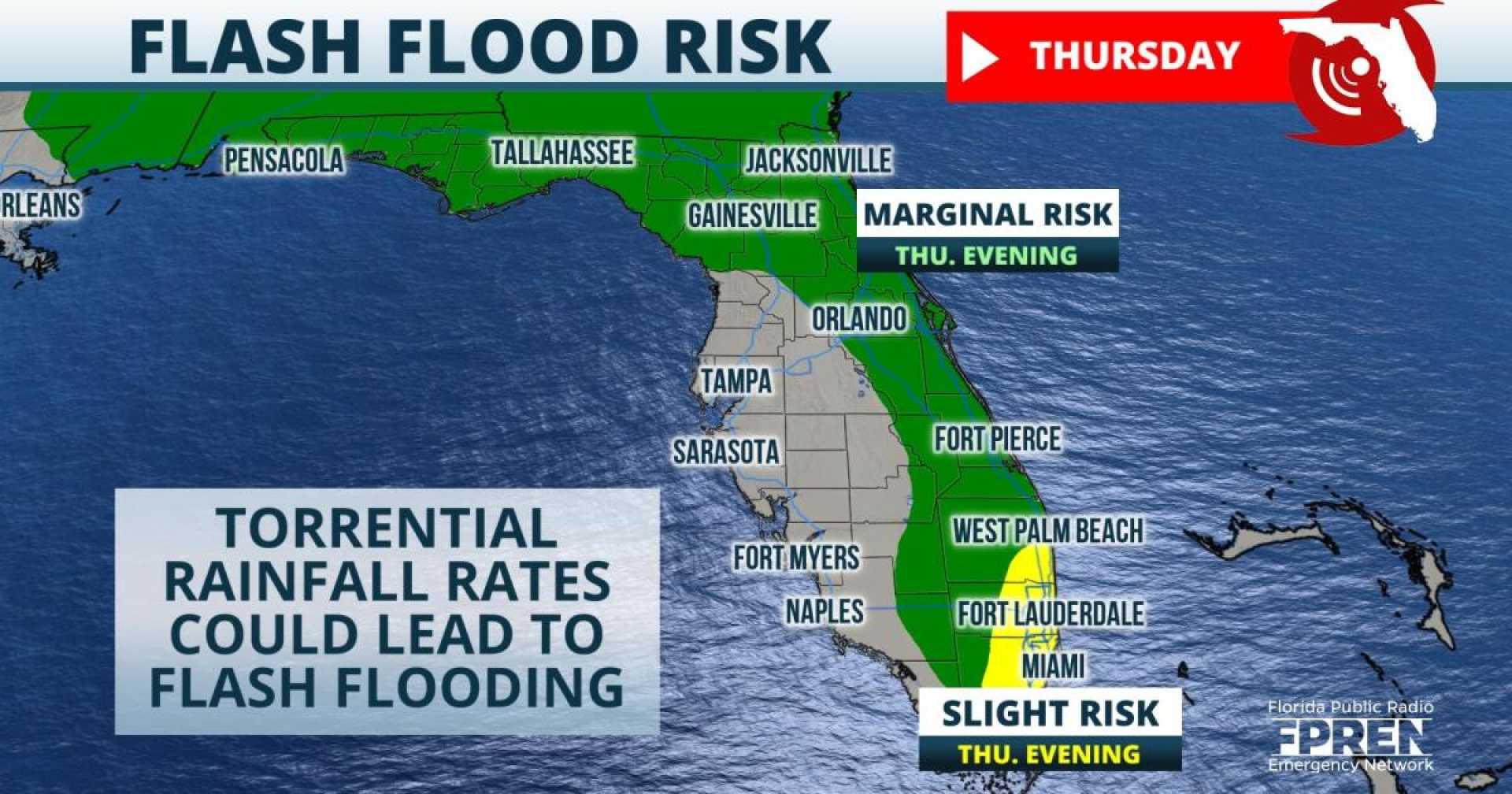
According to the NHC, a flash flood threat has been issued for much of Florida’s Atlantic coast, with a Level 1 out of 4 warning in place until Sunday. Parts of the Space Coast are under a Level 2 threat for Friday and Saturday.
Rain totals may reach between 3 and 5 inches along the east coast, with isolated spots potentially seeing up to 8 inches by Monday. Areas known as Florida’s Treasure Coast, Space Coast, and First Coast are expected to receive the heaviest rainfall.
This wet weather pattern emerges even as parts of Florida, particularly the Gulf Coast, continue to experience dry conditions. Some areas have recorded the driest September on record, while others saw significant rainfall, creating a stark contrast across the state.
<p"The conditions are atypical for Florida, as some regions are grappling with long-lasting drought, while others face potential flooding," the meteorologist commented.
In addition to heavy rainfall, increasing onshore flows may raise coastal flooding risks in low-lying areas. Residents are urged to monitor their local forecasts as the heavy rains build throughout the weekend and peak on Monday.