News
Severe Weather Threat Looms for East Texas This Thanksgiving Week
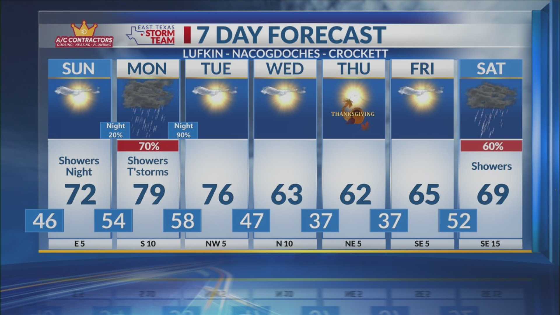
EAST TEXAS (KLTV/KTRE) – Monday, November 24, 2025, has been declared a First Alert Weather Day in East Texas due to the forecast of heavy rain and severe thunderstorms.
Showers and thunderstorms are expected to begin late Sunday night, increasing in coverage through Monday. Residents may see an additional 1-2 inches of rain on top of what has already fallen in recent days, leading to concerns about water ponding on roads as Thanksgiving week kicks off.
Flooding is particularly possible in the northern half of East Texas, prompting a Slight Risk (Level 2/5) warning from the Storm Prediction Center for strong to severe thunderstorms. Strong winds, small hail, and possible tornadoes could occur, especially during Monday afternoon and evening.
While isolated chances for large hail and tornadoes are present early in the day, the main severe threats are anticipated in the afternoon. A disorganized line of storms will move across the region overnight, eventually reaching areas such as San Saba and Mills counties before sunrise, likely weakening as it progresses.
The main severe weather risk will arise from the atmosphere becoming unstable by early afternoon along a warm front. Individual thunderstorms could develop into supercells, increasing the chances for severe weather, although these storms will be limited to areas east of I-35.
Weather models show vast uncertainty regarding the timing and exact locations of these storms, making continuous monitoring imperative. The afternoon storms may start up around early afternoon but could diminish by dinner time as more stable air moves in from the west.
In summary, while the early morning may bring isolated hail to western counties, the afternoon poses the greatest risk for severe weather, with large hail and possible tornadoes for some areas.


