News
Severe Winter Weather Hits Wisconsin and Michigan Ahead of Holidays
MADISON, Wis. (WMTV) – Meteorologists have declared today a First Alert Weather Day as strong winds and snow are expected across southern Wisconsin. A low pressure system moving in from the west is set to intensify, bringing snow showers that will taper off later in the day.
The Wind Advisory remains in effect for all of southern Wisconsin until 6 p.m. Wind gusts are anticipated to reach between 40 and 50 mph, with sustained winds of 30 to 35 mph. Meanwhile, cold air is sweeping through the region, pushing high temperatures down to the 20s over the next week.
Looking ahead to the weekend, another system will bring more snow on Saturday, with several inches of accumulation possible depending on its track. Saturday is also designated a First Alert Weather Day. Snow is forecast to wind down Saturday night, giving way to drier conditions on Sunday.
In WAUSAU, Wis., winter-like temperatures are also expected to arrive early next week, with snow possible and gusty winds impacting holiday travel. Partly cloudy conditions are anticipated for Monday, followed by a cold front that could lead to rain and snow as temperatures dip into the 20s.
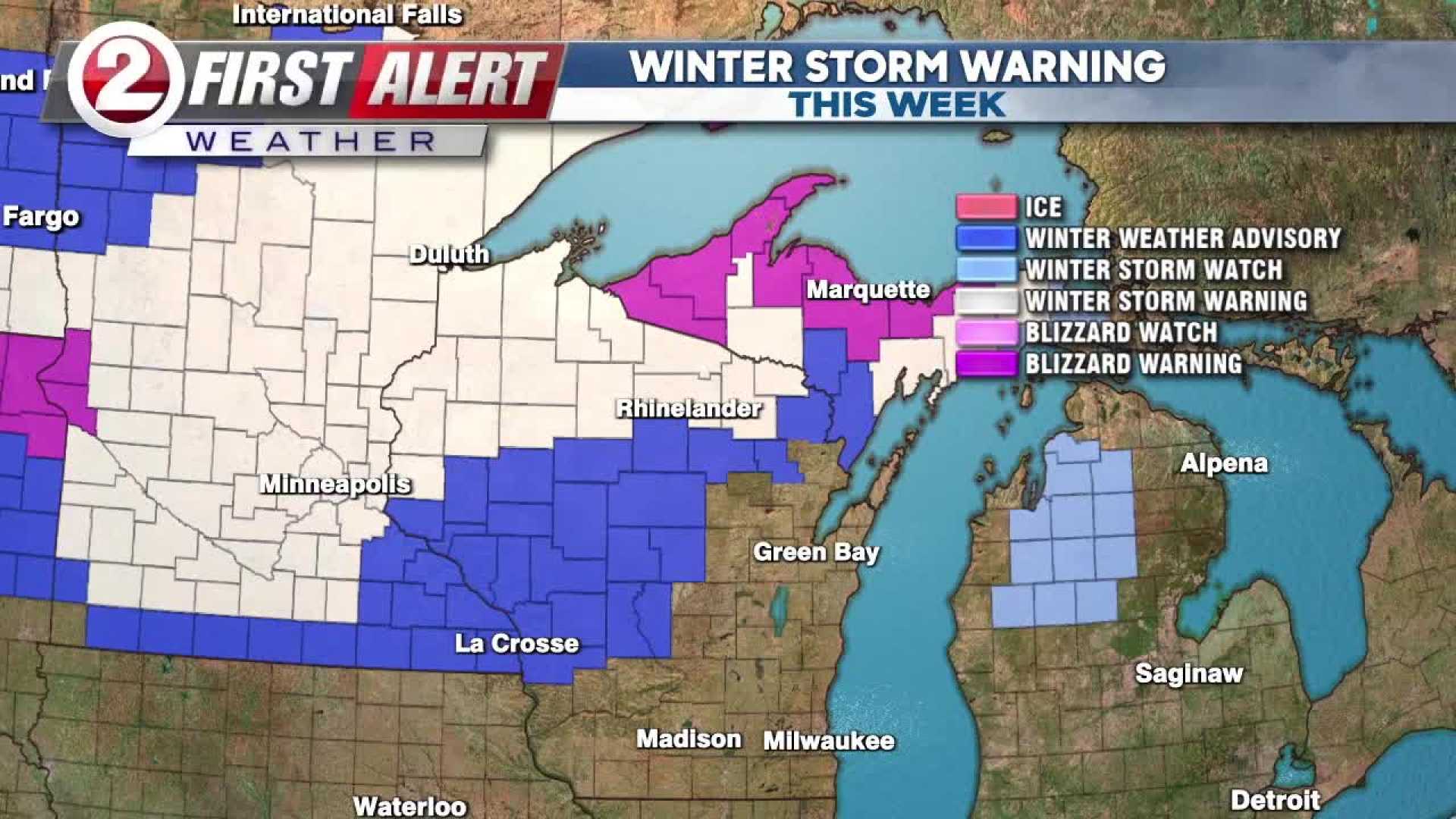
WEST MICHIGAN is bracing for a significant winter storm as well, with a WEATHER READY ALERT issued for travel disruptions. Between Wednesday and Friday, 3 to 7 inches of snow are forecast, with some regions potentially getting more. A Winter Storm Warning is in effect for several counties, including Allegan, Kalamazoo, and Van Buren, from Wednesday morning through Thursday evening.
Travelers can expect low visibility and slick roads on Wednesday due to snow and strong winds, with wind gusts reported at up to 60 mph along the lakeshore. Although snow will continue on Thanksgiving Day, it will be less widespread than on Wednesday. Chilly conditions will persist throughout the holiday weekend with a chance of additional snow.


