News
Isolated Showers Expected Today as Warm Weather Continues in Pittsburgh
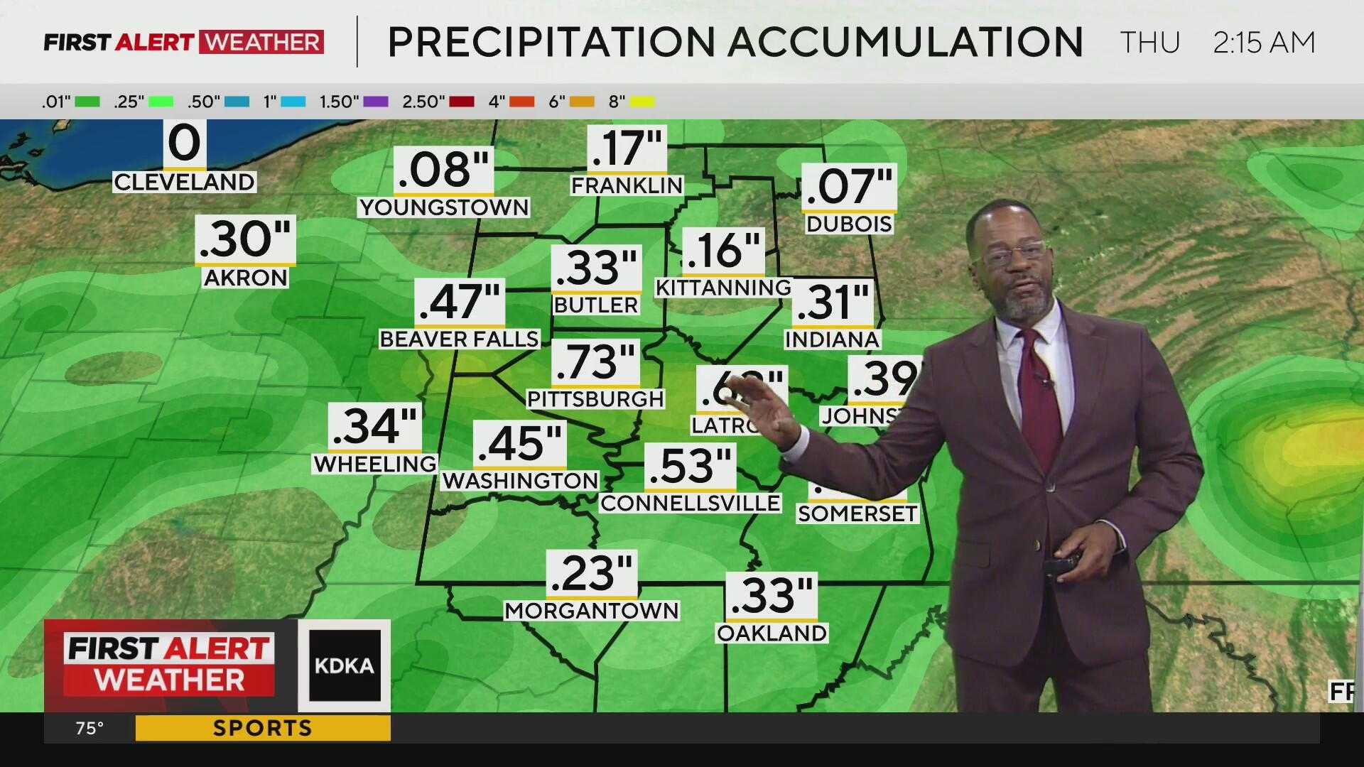
PITTSBURGH, PA — Isolated showers are expected today as a weather front moves through the region, bringing limited rain coverage.
Most areas in western Pennsylvania will not experience significant rainfall, especially near and north of US-422, which saw some rain this morning. The dry conditions will likely extend into the early afternoon, providing a brief respite from the season’s warm temperatures and humidity.
A front is moving in that may trigger additional isolated showers and embedded storms later in the day. While no strong storms are anticipated, the potential for downpours exists in Pittsburgh and further south. The radar indicates that conditions will settle down by dinnertime.
The week begins quietly, characterized by a slight decrease in temperature and humidity. However, a stalled boundary is expected to bring more showers and storms on Tuesday and Wednesday. Tuesday will likely remain dry until late afternoon. The rainiest day is predicted to be Wednesday, as a cold front sweeps through, potentially leading to locally heavy rain.
This week’s heat will be manageable, with afternoon highs in the upper 80s, followed by a return to more seasonal temperatures post the mid-week front. The pleasant weather is set to continue into the weekend.
For this Sunday, the forecast includes sun and clouds with isolated showers possible, particularly in the afternoon. Highs will reach around 87°F. Rain is expected to clear out early, with lower temperatures at night around 64°F. As the week progresses, Monday will be partly cloudy with a high of 83°F, and Tuesday should see a mix of sun and clouds, with a late-day rain chance.


