News
Severe Weather Threat Looms Over the South This Weekend
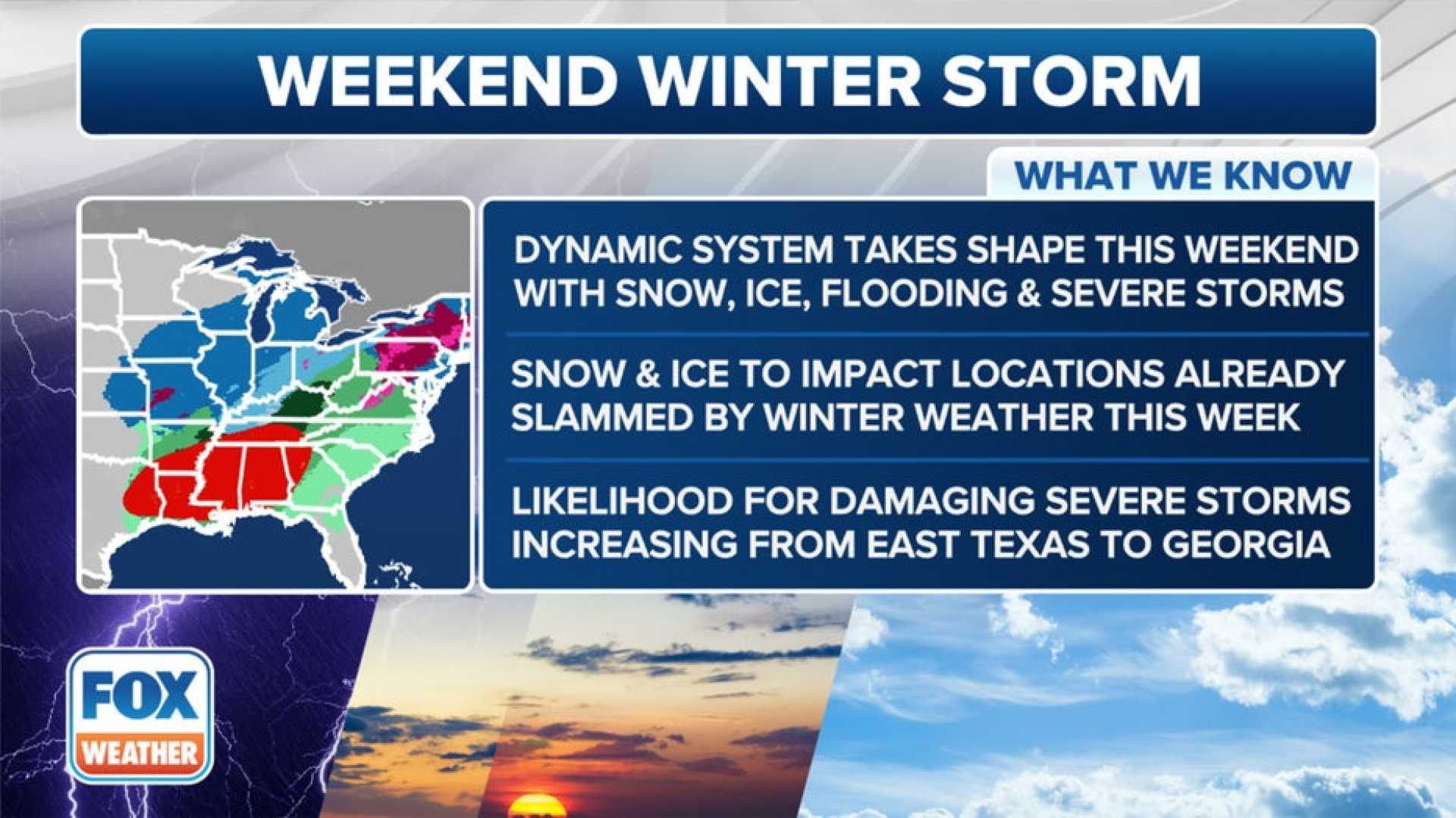
MEMPHIS, Tenn. – A significant weather event is poised to impact the Mid-South this weekend, with a Flood Watch in effect from Friday evening until 6:00 a.m. Sunday. Meteorologists predict severe storms that could include tornadoes and substantial rainfall, raising the risk of flash flooding in the region.
According to the National Weather Service, a powerful storm system is expected to bring dangerous conditions, particularly across southern states. Damaging gusts and various severe weather phenomena are anticipated as storms begin to affect the area on Saturday morning, with potential for the most intense storms arriving by noon.
The Storm Prediction Center has issued a Level 3 out of 5 risk for severe storms in parts of Tennessee, Mississippi, and Arkansas. Rainfall amounts are forecast to range between 2 and 6 inches, with some localized areas possibly receiving 6 to 8 inches. As a result, significant flash flooding could impact low-lying and flood-prone regions, especially in areas not typically susceptible to flooding.
“This setup poses a particularly dangerous situation, and we urge the public to stay informed and be prepared,” said FOX Weather Meteorologist Steve Bender. “Excessive runoff from the rainfall may lead to serious flooding concerns across the Mid-South, especially during the afternoon and evening hours.”
As the storms move northeast, snowfall is predicted to follow next week. A transition back to colder temperatures is expected, with a potential snow event arriving on Tuesday night into Wednesday. Forecast models indicate the possibility of accumulating snow in areas including parts of Kentucky and Tennessee.
Additionally, strong winds could exacerbate travel hazards, creating dangerous conditions on the roads. The Winter Storm Watch is already in effect for parts of the region, and warnings of wind chills hitting single digits might follow the snow events.
Local officials are advising residents to avoid driving through flooded areas and to be mindful of road conditions. “We cannot stress enough the dangers of flooding. It can occur rapidly, and as little as one foot of moving water can sweep a vehicle off the road,” authorities caution. “Drivers should always heed warnings and stay aware of their surroundings during such extreme weather.”
This weather system is part of a more extensive pattern affecting the broader southeastern United States, where cities along the Interstate 95 corridor are also under similar threats for severe weather.
Residents are encouraged to prepare for potential power outages and to have emergency kits ready, as storms could disrupt essential services.


