News
Tropical Storm Jerry Hits Leeward Islands with Heavy Rain and Flash Flooding Risks
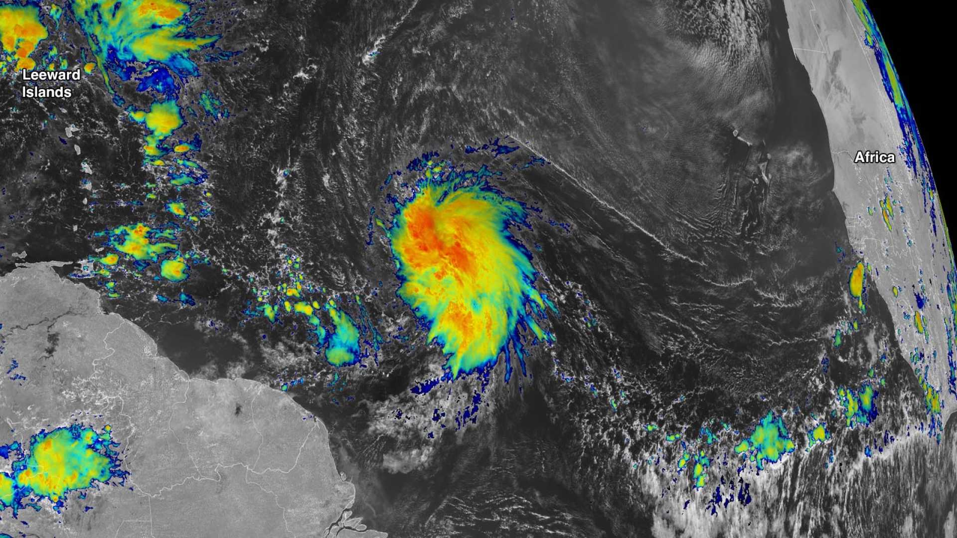
MIAMI – Tropical Storm Jerry continues to bring heavy rain to the Leeward Islands while posing no threat to the mainland U.S. As of Friday morning, Jerry is located about 80 miles northeast of the northern Leeward Islands and moving northwest at 17 mph.
The National Hurricane Center (NHC) reports that Jerry is battling moderate to strong wind shear, which has hindered its wind intensity. Despite these challenges, the storm is expected to deliver rainfall amounts between 2 to 6 inches, with some areas seeing locally higher totals of up to 6 inches. Flash flooding is a significant concern, particularly in hilly or mountainous regions.
Heavy rain has already begun soaking parts of the Lesser Antilles, extending as far south as St. Vincent and the Grenadines, with rainfall rates potentially reaching 1 inch per hour. The NHC has issued tropical storm alerts for various regions in the northern Leeward Islands. Jerry is also producing dangerous swells that could lead to life-threatening surf conditions across the Greater Antilles.
In a forecast update, the NHC has diminished the likelihood of Jerry attaining hurricane strength. Maximum sustained winds have decreased to 50 mph, coupled with higher gusts. Weather experts believe the storm will struggle to gain further power and may ultimately shift into the central Atlantic this weekend, taking an eastward turn away from Bermuda by late Sunday or Monday.
Meanwhile, a separate weather event, Subtropical Storm Karen, has formed in the far North Atlantic but is anticipated to dissolve quickly. Karen, captivated by both tropical and extratropical features, is expected to lose its sustaining thunderstorms by Saturday. As of now, authorities continue monitoring this storm’s development.
As conditions evolve, the NHC will send aircraft to gather more data on Jerry’s progress. The storm represents the 10th of the 2025 Atlantic hurricane season, appearing about two weeks behind average timelines for this point in the season.


