News
Coastal Flooding Expected for Hatteras and Ocracoke Islands
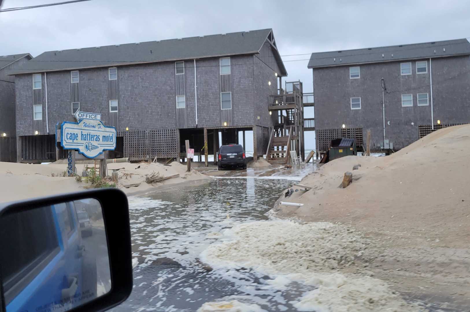
Hatteras, North Carolina — Higher astronomical tides combined with strong northeast winds are expected to cause coastal flooding on Hatteras and Ocracoke Islands this week. The National Weather Service issued a warning about the conditions, particularly during high tide periods.
Minor ocean overwash was observed in northern Buxton starting at 6:30 a.m. local time on Tuesday, which happened approximately two and a half hours before the high tide. Despite the flooding risks, North Carolina Highway 12 remained open and passable as of 7:00 a.m. on Tuesday. Nonetheless, travelers are warned to exercise caution while driving due to the potential for saltwater damage to vehicles.
The Hatteras-Ocracoke ferry is operating on a limited schedule because of the current weather conditions. Reports of minor to moderate overwash have also emerged from northern Ocracoke Island, and a Coastal Flood Advisory is in place for Hatteras Island until noon.
A high risk for rip currents is currently affecting the Outer Banks region, particularly from Cape Point in Buxton and extending to north of the Outer Banks. The Coastal Flood Advisory indicates that water levels may reach between one to two feet above normal during high tides expected at approximately 9:30 p.m. on Tuesday and around 10 a.m. on Wednesday.
Forecasts predict continued dangerous conditions, including a potential for severe longshore currents that could persist throughout the week. Local residents and visitors are advised to stay informed through the National Weather Service’s Facebook page and prepare for fluctuating weather as high winds are anticipated to shift by Wednesday.