News
Severe Weather Expected Across Southeastern Texas Today
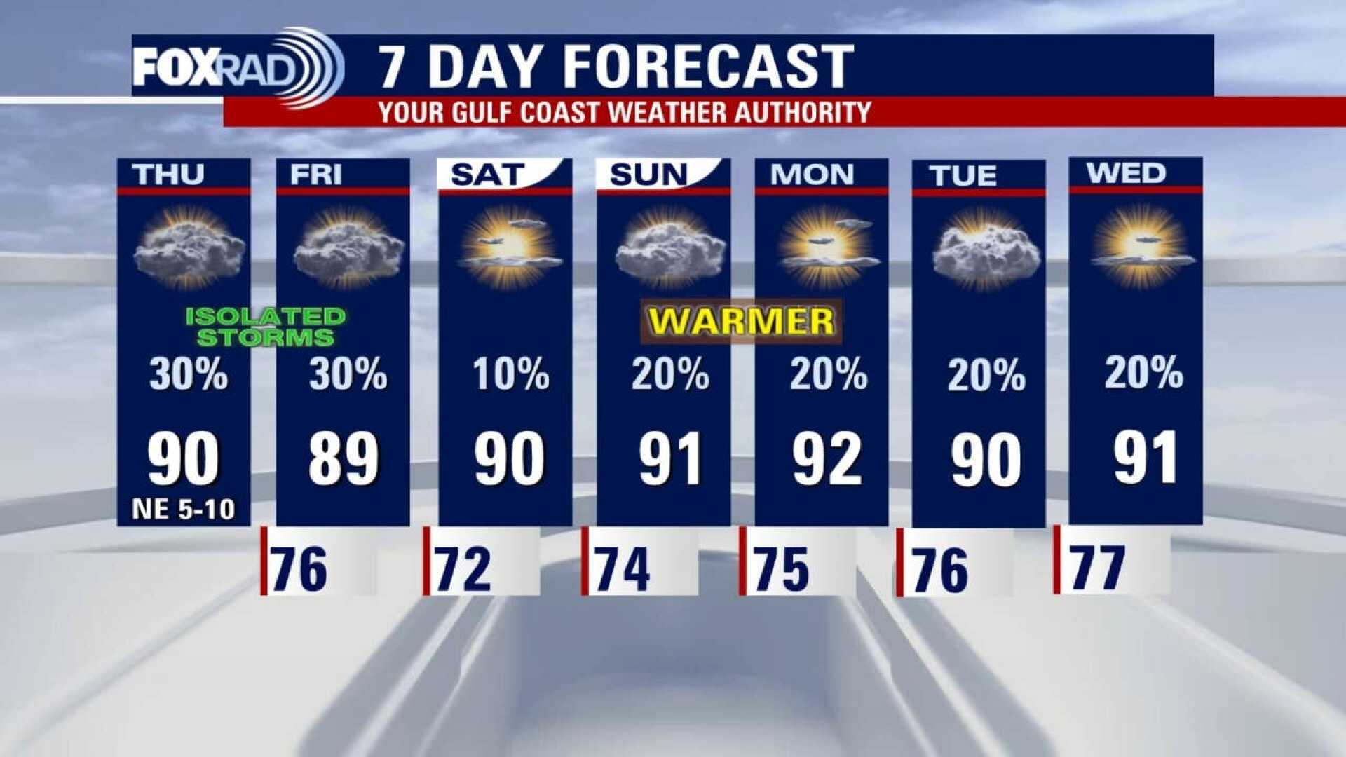
HOUSTON – A cold front is expected to push a line of storms across Southeastern Texas today, particularly affecting areas north of I-10 and west of I-45. As the storms move southeast towards Houston, the rain will begin to weaken.
The frontal boundary will continue to slide south along the coast, bringing scattered showers and storms mainly south of I-10 by this afternoon. By sunset, high pressure moving in behind the storms will set the stage for a pleasant Saturday forecast across the Houston area.
Overnight storms have shifted south toward Laredo and San Antonio, causing most of the activity near Brenham and Bastrop to weaken. Isolated showers may occur near Columbus, El Campo, and Matagorda by lunchtime, but most of the storm activity is anticipated to remain east of Houston.
Residents can expect high temperatures in the upper 80s to near 90 degrees today. The upcoming weekend looks to be more summer-like, with isolated pop-up showers and storms that are not expected to disrupt outdoor plans.
Another disturbance might arrive late Saturday into Sunday, however, the weather is expected to dry out as the region moves into early June. Typical summer temperatures in the low 90s and slim chances of rain are forecasted.
The 2025 hurricane season starts this Sunday, June 1st, with currently quiet conditions reported across the Gulf and into the tropics.
The 10-day forecast indicates that storms are expected to diminish by Friday, returning to a more typical summer pattern for the weekend ahead.
For more details, Houston’s weather will be explained by KPRC 2’s Chief Meteorologist Anthony Yanez.


