News
Severe Weather Alerts for Saturday in Southern Wisconsin
MADISON, Wis. (WMTV) – A First Alert Day is in effect for Saturday as southern Wisconsin braces for likely showers and thunderstorms starting early in the morning. Multiple weather systems are expected to interact, leading to potential severe weather.
Forecasters are warning of gusty winds and brief heavy rainfall with stronger storms, especially south of I-94. There is a possibility for a widespread severe weather event if overnight systems merge with higher instability. Conversely, isolated storms could appear if instability remains limited.
Morning thunderstorms are expected to dissipate by midday. In the afternoon, a cold front associated with a weak low-pressure system will pass through the region, potentially igniting more thunderstorms in southern Wisconsin.
The strength of these afternoon storms will depend on cloud cover. If cloudy skies prevail, storms could remain weak. Conversely, breaks of sunshine may lead to more intense storms capable of damaging winds and large hail.
As the day progresses, any storm activity should clear the region by Saturday evening. Looking towards next week, a stationary front combined with nearby high pressure might keep low-end storm chances active, particularly near the Wisconsin-Illinois border.
Heat and humidity are anticipated to build again by Tuesday, with temperatures climbing into the upper 80s and lower 90s. Intermittent chances for storms could persist into Friday of next week, though the timing of these events remains uncertain.
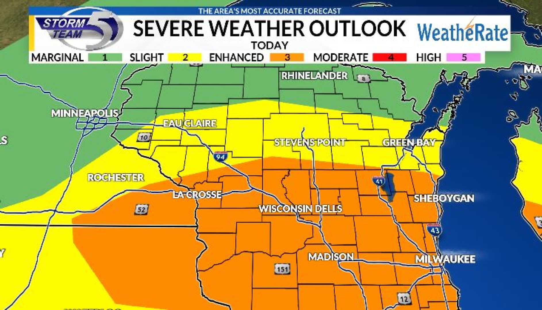
As of Saturday morning, much of southern Wisconsin is under a level 2 out of 5 severe weather risk, with primary concerns of damaging winds and large hail, particularly impacting the southwestern corner of the state. A level 1 out of 5 risk is issued for areas like La Crosse, where isolated storms may occur, yet severe risks appear to diminish as the morning progresses.
By late afternoon, clear skies are expected to lead to a drier end to the weekend. However, as the region transitions into next week, forecasts indicate a ‘ring of fire’ pattern which may bring near-daily chances for storms as the heat increases.


