News
Metro Detroit Faces Snowstorm with Significant Accumulation This Weekend
DETROIT, Michigan – Following a snowstorm that hit Metro Detroit Saturday night, communities woke up to 3 to 6 inches of fresh snow on the ground by Sunday morning. Snow started falling Saturday afternoon, with the heaviest accumulation expected between 6 p.m. and 2 a.m. Sunday.
Roads were snow-covered early Sunday, and while crews worked diligently to clear most main roads, light snow showers continued to leave some areas susceptible to slick conditions. Meteorologists warned that moisture left on untreated residential streets could refreeze overnight as temperatures drop, leading to potentially hazardous driving conditions on Monday morning.
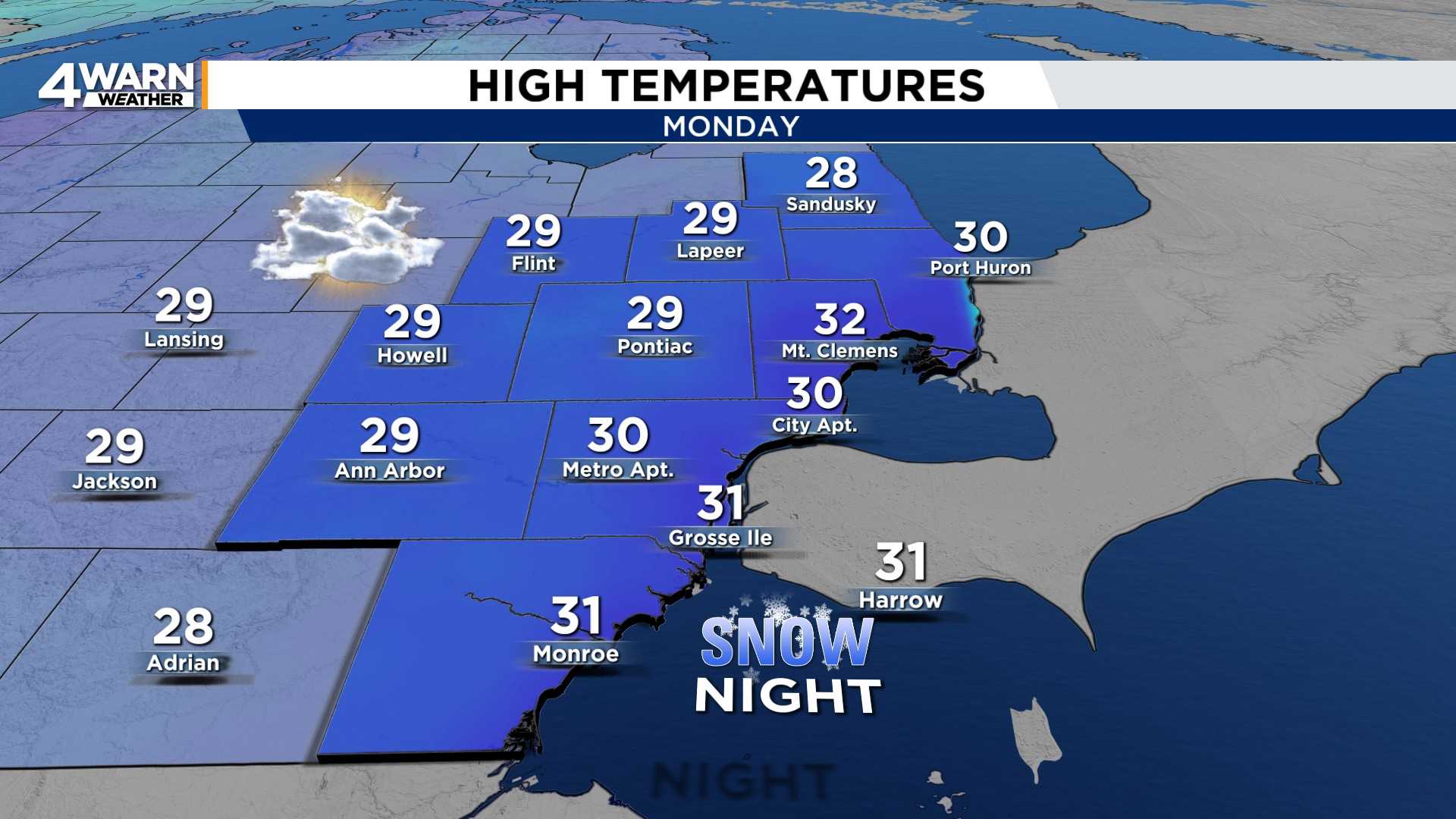
The upcoming week promises more weather changes, starting with cold air settling in on Monday. Highs in Metro Detroit are predicted to reach near 30 degrees, with slightly colder temperatures in the Thumb area. Another round of light snow is anticipated Monday night into Tuesday, though this system is expected to be less severe, delivering between a half-inch to 2 inches of additional accumulation.
Travelers should plan for slower commutes early Tuesday due to the forecasted snowfall. By midweek, expect mostly cloudy skies with temperatures remaining in the lower to mid-30s. Another chance for light snow may return late Wednesday, adding to the already chilly conditions.
As the week progresses, temperatures are set to drop significantly, especially towards the end of the week. By Thursday and Friday, highs may only reach the lower to mid-20s, with overnight lows falling into the teens, and some outlying areas may even see single-digit temperatures. This will be the coldest stretch of the season thus far.
Residents are encouraged to prepare for a chilly week ahead, as additional light snow is forecast for Friday night into Saturday morning, with unsettled weather expected to persist through the weekend.


