News
Midwest Faces Severe Weather Threat This Week
CHICAGO, Ill. — A severe weather threat is escalating across the Midwest, with major cities like Chicago and Milwaukee preparing for storms that could produce hurricane-force winds and tornadoes. A Tornado Watch has been issued for McHenry County until 10 p.m. on Thursday.
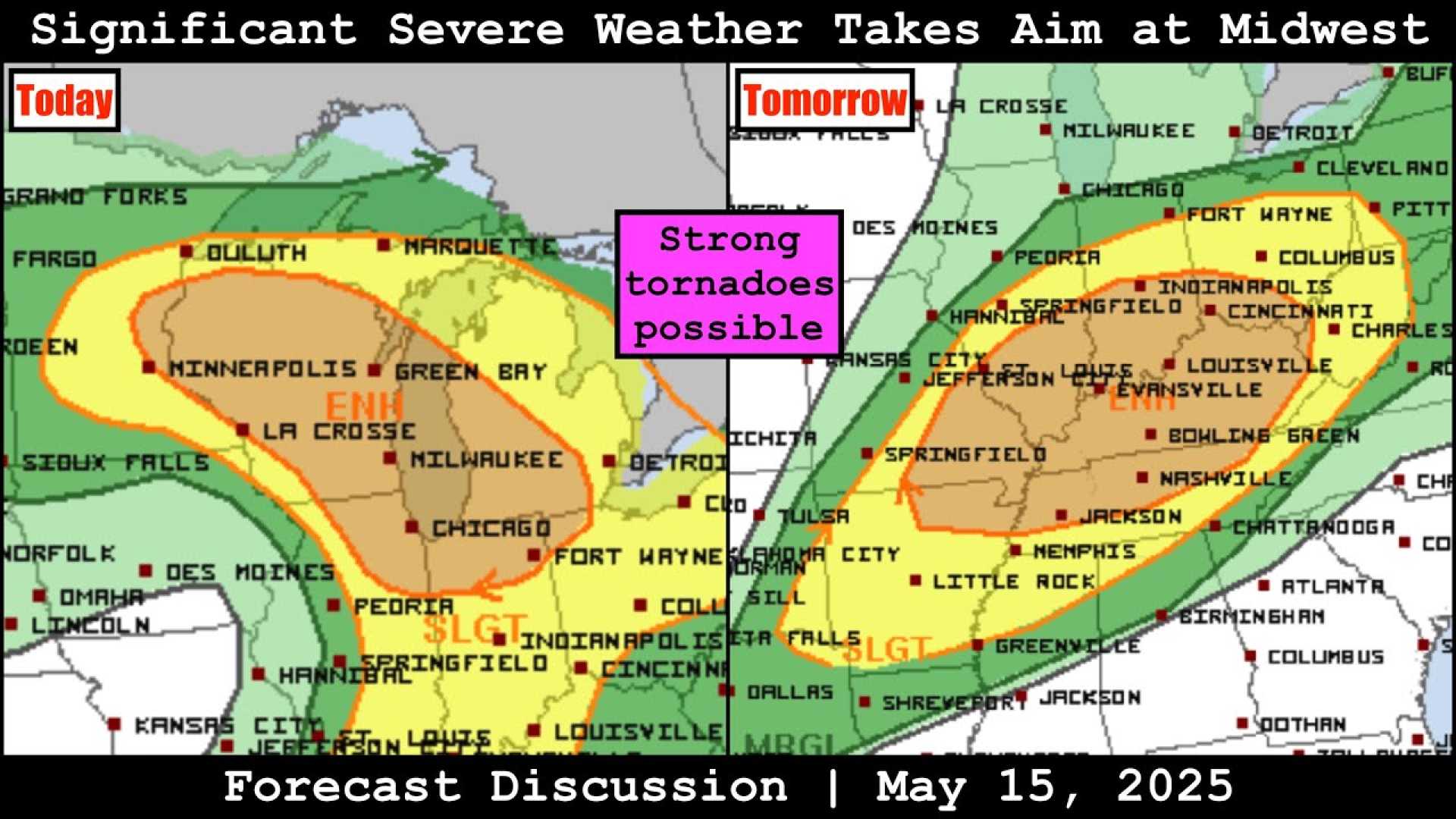
The National Weather Service and NOAA‘s Storm Prediction Center have warned over 23 million people across the Midwest, including in Chicago, Milwaukee, Madison, and St. Paul, to brace for severe thunderstorms. The enhanced risk level of 3 on a scale of 5 signifies a significant potential for powerful storms.
On Thursday, temperatures are expected to climb into the upper 80s and low 90s, possibly breaking a record high of 91 degrees set on May 15. Meteorologists predict storms developing by mid-afternoon as a cold front meets warm, moist air from the Gulf of Mexico. Supercells are likely to be the initial storm formation, followed by a line of storms moving northeast into the evening.
Some storms may bring hail over 2 inches in diameter and wind gusts exceeding 75 mph. Tornadoes rated EF-2 or stronger are also a concern. Later in the evening, skies will clear, leading to lower temperatures in the 60s.
The severe weather threat will return on Friday afternoon and evening with additional storms likely. The weekend forecast indicates cooler and calmer weather with highs in the 60s. However, more rain is expected to develop by Tuesday and Wednesday.
FOX Forecast Center Meteorologists have noted the potential for severe storms following an upper-level disturbance moving into the central United States. Various reports have already confirmed significant wind gusts and hail from recent storms across Nebraska and Colorado.


