News
Phoenix Faces Major Weather Shift Just Before Christmas
PHOENIX, Arizona — Record-breaking temperatures in Phoenix are set to change dramatically just in time for the holidays. The high on Monday reached 83 degrees, surpassing the previous record of 79 degrees set in 1917.
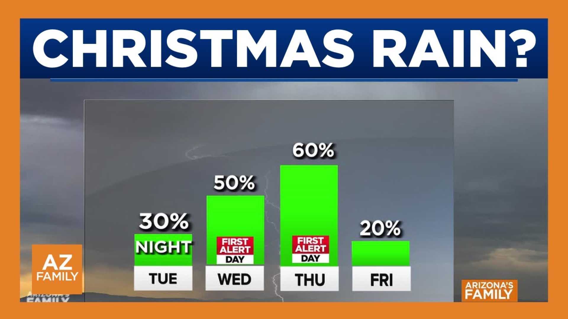
This week, high pressure that has caused the unseasonably warm weather is expected to decline. A trough of moist air will push against the West Coast, bringing moisture over Arizona starting Tuesday. Rain is projected to begin Tuesday night and continue into Wednesday morning.
The initial showers will likely be light, but a second round of rain is forecasted for Wednesday evening, with heavier downpours expected through Christmas Day. Meteorologists anticipate the highest chance of rain on Christmas morning, with scattered showers lingering throughout the day.
The forecast calls for a high of 79 degrees on Tuesday, decreasing to 75 on Christmas Eve and 73 for Christmas Day. Snow is possible in higher elevations above 9,000 feet.
With recent snowfall in the high country, the Arizona Department of Transportation urges drivers to avoid parking on highways to play in the snow, as it poses safety risks. ADOT recommends being prepared for winter driving conditions.
The National Weather Service has noted this December may be the hottest on record for Phoenix, with an average temperature of 62.9 degrees. La Niña conditions in the Pacific are contributing to this pattern, while climate change is exacerbating the frequency of extreme temperatures.
As the Valley embraces this transition in weather ahead of the holidays, residents are reminded to stay informed through local weather updates.


