Cold Front Brings Rain and Strong Storms to South Florida
WEST PALM BEACH, Fla. — South Florida is bracing for a weekend cold front that is expected to bring rain and possibly severe thunderstorms early Monday morning. Meteorologists forecast temperatures today to remain in the low 80s, warming significantly before the front pushes through overnight.
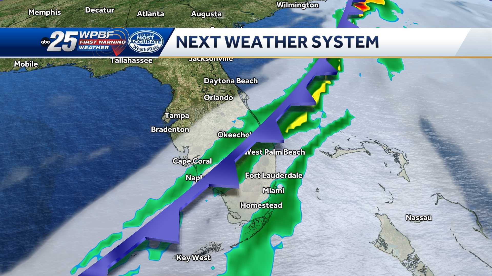
The cold front will arrive late Sunday into Monday, triggering a chance for scattered rain. According to WPBF 25 First Warning Meteorologists, precipitation could start as early as 8 AM on Monday, with the best chances for rainfall occurring between 3 and 8 AM. Gusty winds may accompany the effects of the front, with gusts exceeding 40 to 60 mph.
“While the tornado threat is considered to be low at this point, we do not rule out an isolated strong storm during the cold front’s passage,” said WPBF Meteorologist. “This system is capable of producing strong wind gusts and potentially isolated hail.”
As the cold front moves through, meteorologists expect a drop in temperatures, with daytime highs on Monday hovering in the mid-70s. A fire weather warning will go into effect due to strong winds and low humidity across the region, prompting precautions for residents and sensitive activities.
Following the front’s passage, temperatures are predicted to fall into the mid-50s overnight on Monday, nearly 10 degrees below average for this time of year. Residents can expect clearer skies and drier conditions as high pressure builds back in by Tuesday.
By Tuesday afternoon, temperatures are forecast to return to normal, with highs back in the upper 70s to low 80s. Conditions are expected to remain pleasant through the week, though slight chances for isolated rainfall may remain as additional weak cold fronts approach the area.
Residents are encouraged to stay tuned for updates on the approaching weather system and to prepare for potentially hazardous conditions early Monday morning. Keeping multiple sources for weather alerts handy is advised during this period of active weather.