News
Severe Weather Threat Looms Over Texas, Oklahoma, and Kansas
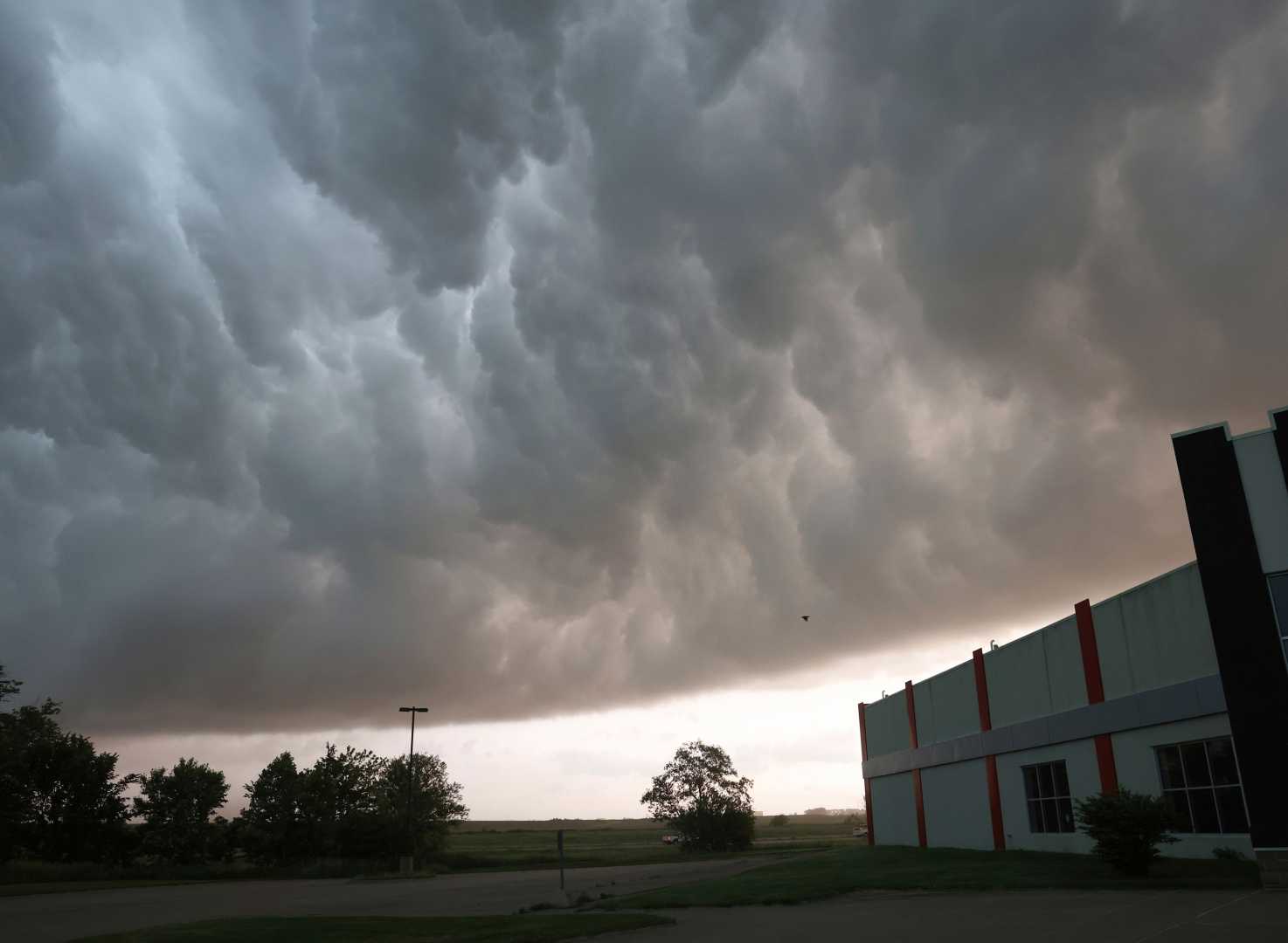
AUSTIN, Texas — A dangerous weather system is poised to sweep through parts of Texas, Oklahoma, and Kansas on Tuesday. Meteorologists predict severe thunderstorms that could generate hailstones as large as baseballs and damaging winds, potentially impacting millions of residents and threatening property.
Forecasts indicate that these storms may wreak havoc, especially in areas prone to multiple storm developments. Hailstones reaching roughly 2.75 inches in diameter can shatter windows, destroy crops, and damage solar panels, according to insurance industry data. Residents in high-risk zones are advised to secure property and devise emergency plans.
AccuWeather reports that the storm threat area extends from northeast Kansas through Oklahoma into western Texas and extreme eastern New Mexico. Forecasters are warning residents to prepare for hail capable of causing severe damage to roofs and vehicles, as well as wind gusts strong enough to uproot trees and knock down power lines.
Tom Kines, a senior meteorologist with AccuWeather, informed Newsweek, “It’s challenging to pinpoint an exact location for where the large hail may occur, but the chances are heightened from west Texas up into Oklahoma.” He emphasized that the entire forecast region should brace for this potential threat.
As of Tuesday afternoon, the National Weather Service (NWS) had not issued any severe weather alerts for the affected areas. However, several NWS offices have released hazardous weather outlooks warning of the storms’ impending impact.
This latest storm threat follows a significant weather outbreak that occurred over Easter weekend, resulting in more than 435 reports of hail. In Nebraska, storms produced wind gusts up to 82 mph and baseball-sized hail, leading to extensive structural damage in Fremont. Additional severe weather impacted Oklahoma and Texas, with an EF1 tornado causing destruction in Ada, Oklahoma, and two fatalities reported when a vehicle was swept away in high water in Moore.
The severe weather threat is expected to persist throughout the week. On Wednesday, the threat will shift slightly west, affecting western Kansas, western Nebraska, eastern Colorado, and more areas in Oklahoma, Texas, and New Mexico. By Thursday, that threat will extend from northern Kansas down through central Texas.
By Friday, storms will advance eastward potentially impacting the Mississippi and Ohio valleys, where flash floods could pose a hazard due to the recurring nature of storms, according to AccuWeather forecasters. A hazardous weather outlook from NWS Dodge City, Kansas, warned, “Locally severe storms possible south of a Stafford to Greensburg and Ashland line after 5 PM.”
NWS in Lubbock, Texas, shared a notice on X, formerly Twitter, stating, “Warm and quiet conditions this morning with highs in the 80s. However, conditions will change by the afternoon, with scattered thunderstorms expected to develop west of the I-27 corridor. The main threats with these storms will include large hail and damaging wind gusts!” Severe storms are anticipated to continue affecting the area for the rest of the week.
AccuWeather warns that thunderstorms capable of producing severe weather could emerge in Kansas on Wednesday evening, with some regions at risk for excessive rainfall.
Kines noted that severe storms might return to the Texas and Oklahoma area by early next week.


