News
Tornado Warnings and Severe Storms Hit North Texas This Weekend
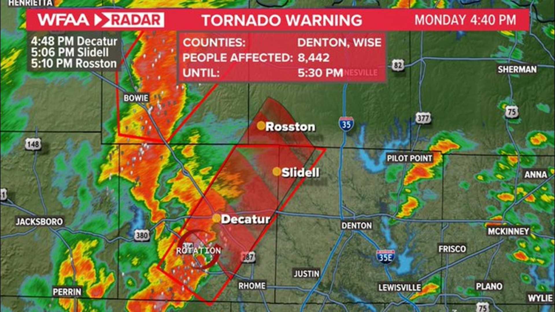
DALLAS, Texas — A series of tornado warnings and severe weather alerts were issued across North Texas Saturday, with multiple counties under threat until late in the evening. The National Weather Service (NWS) reported a tornado warning for Erath and Hood counties until 9:30 p.m., while Palo Pinto and Parker counties were under a warning until 10 p.m.
A flash flood warning was also in effect for Jack and Montague counties until 10 p.m. Tornado watches remained active for a broad region, encompassing Jack, Denton, Wise, Palo Pinto, Cooke, and Parker counties, all set to expire at midnight. A severe thunderstorm warning was earlier issued for areas west of the Dallas-Fort Worth Metroplex but was later allowed to expire.
Reports of storm-related damage began emerging Saturday evening, with the Granbury Volunteer Fire Department stating that a tornado impacted a home southwest of Tolar, roughly an hour from Fort Worth.
The storms, predicted to lose intensity as they approached the Metroplex, are forecast to bring heavy rain and thunderstorms throughout the night. Notably, the highest precipitation totals could reach up to five inches in isolated areas in northwest Texas. However, the ongoing severe weather raised concerns for potential flooding and severe storms later in the night.
As the night wore on, thousands experienced power outages across North Texas. Initial reports indicated over 11,000 customers without power early Saturday morning, but that number dropped to fewer than 1,400 by the evening. Under 500 of those outages were in Tarrant County, with around 300 in Dallas County.
The NWS forecast reflects a sustained chance of rain continuing into the following week, with showers and possible thunderstorms predicted from Tuesday through at least Friday.
By late Saturday evening, the agency announced an additional tornado watch effective until midnight for northern Texas, which included several counties such as Cooke and Denton. Further updates from the NWS highlighted the issuance of a Tornado Warning for Parker County until 10:15 p.m., where reports indicated a tornado debris signature near Cool, moving towards Garner.
A Severe Thunderstorm Warning remained in effect for Montague and Cooke counties due to high winds and large hail. The NWS warned that during the approaching weather event, some areas might see heavy rain, with rainfall totals anticipated to range from 0.5 to 1.5 inches, while some localized regions could receive upwards of 3 inches.
The National Weather Service urged residents to stay informed and be prepared for rapidly changing conditions and potential flooding. With Easter Sunday approaching, clearing skies are expected to follow the stormy weather, with sunny conditions forecasted to return by the afternoon, allowing for Easter plans to proceed.


