Tornado Watch Issued as Severe Storms Hit Central Oklahoma
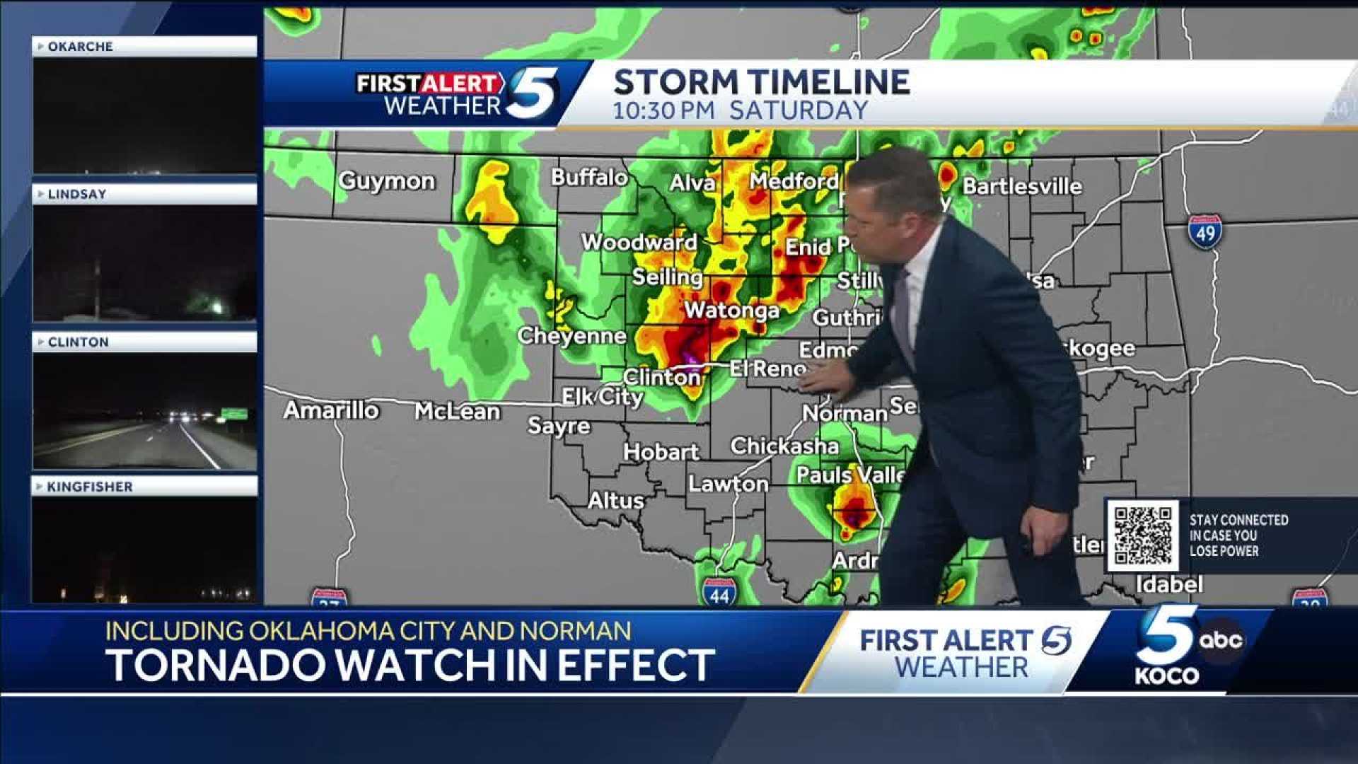
OKLAHOMA CITY, Okla. — A tornado watch has been issued for much of Oklahoma Saturday night as severe storms move across the state, bringing heavy rain and large hail. KOCO 5 Chief Meteorologist Damon Lane warns that while a low threat of tornadoes exists, hail sizes could reach up to golf balls in diameter.
The National Weather Service (NWS) initially issued the tornado watch, predicting the storms would impact central Oklahoma starting around 7 p.m. and continuing into the early hours of Sunday morning. These storms pose a risk of hazardous weather, primarily due to gusty winds and hail.
As of 12:05 a.m. Sunday, the NWS has provided updates for several counties, indicating severe thunderstorm warnings for areas including southwestern Lincoln County, Oklahoma County, and northeastern Cleveland County, among others. Wind gusts in these areas could reach up to 60 mph.
Locations at risk include Oklahoma City, Moore, and Midwest City, with a warning set to expire at 12:15 a.m. The reports from the NWS show continued updates reflecting an ongoing threat across various counties, with significant storm systems affecting multiple regions.
Earlier updates, such as a 10:05 p.m. warning, specified wind gusts of 60 mph and quarter-sized hail impacting areas in Garvin and Cleveland counties, affecting towns like Purcell and Noble.
“This storm system has the potential to create significant hazards with high winds and large hail being the main threats,” Lane reported. He emphasized the necessity for residents to stay updated through reliable channels.
By 10:35 p.m., storm interactions further prompted warnings across western Oklahoma County, with locations such as the Village and Edmond being particularly affected by ping pong ball-sized hail. As conditions evolve, additional updates are expected to follow.
In total, counties on notice include Canadian, Cleveland, Grady, and Kingfisher, among others, highlighting the widespread nature of the storm watch.
As citizens prepare for the incoming storm systems, they are encouraged to download weather apps for real-time alerts and to remain indoors when the severity escalates. The risk is predicted to last until approximately 1 a.m. Sunday.