Atmospheric River Brings Days of Rain and Snow to Southern California
SAN DIEGO, CA — An atmospheric river began impacting Southern California Wednesday afternoon, bringing rain and snow to the region, with effects expected to last through early Friday. As the storm system moves from the northwest corner of San Diego County, it continues to envelop the area, delivering light to moderate rainfall and snowfall in higher elevations.
The inclement weather started in San Diego’s North County, where showers were reported as early as 5 p.m. at the Oceanside Pier. Heavy rain and snow are anticipated, disrupting typical routines for residents across the region.
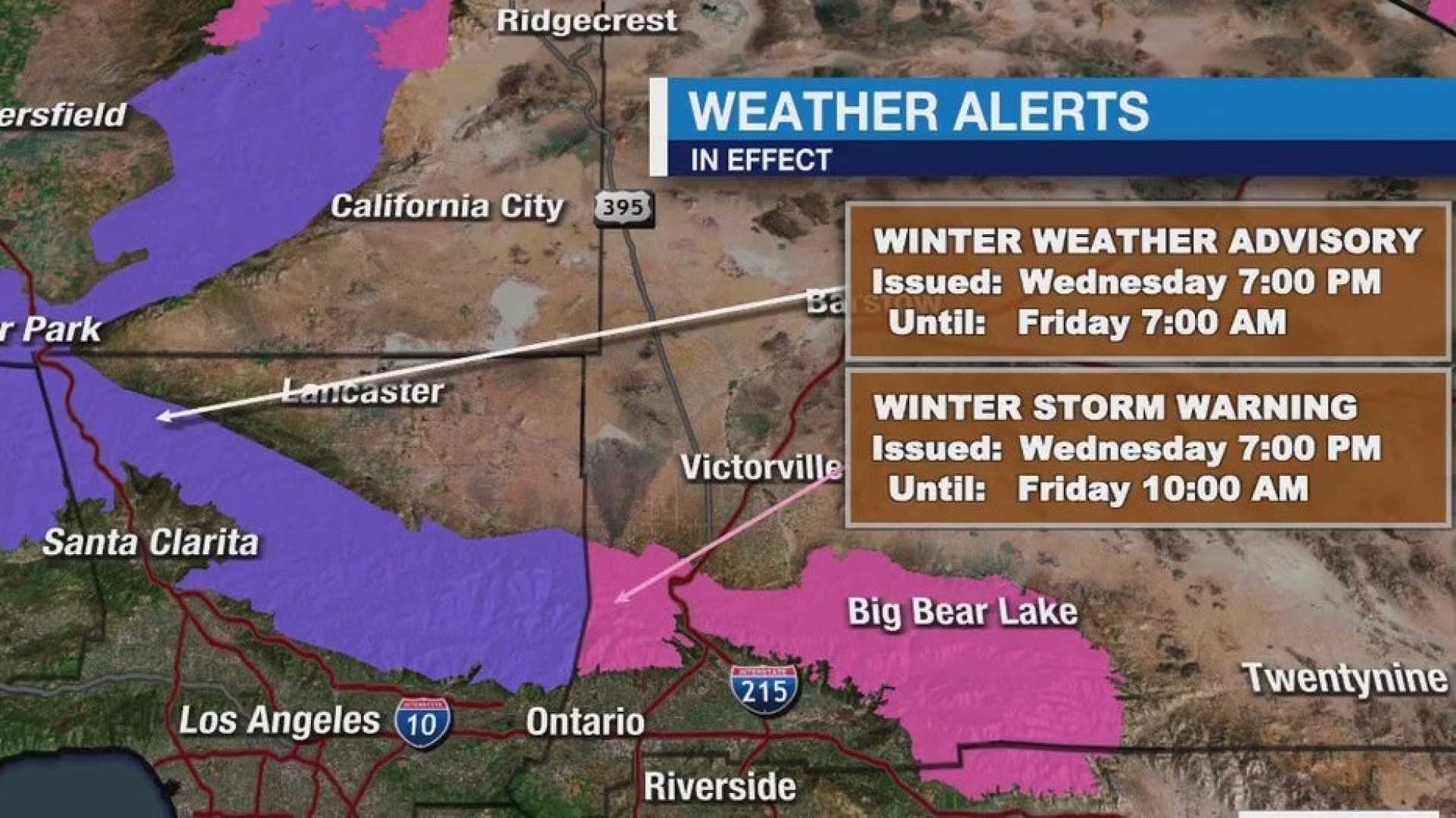
According to the National Weather Service, areas in the local mountain ranges are meant to see significant accumulations of snow, especially above 4,000 feet. A Winter Weather Advisory is set to take effect early Thursday morning, warning of hazardous conditions for travelers in the mountains.
Robbie Munroe, a meteorologist with the National Weather Service in Oxnard, stated, “While the first wave of moisture will taper off by late Wednesday night, a second, stronger wave will begin impacting the area from Thursday afternoon into Thursday evening, coinciding with peak commute times. We could see increased rainfall and potential thunderstorms during this period.”
The initial rainfall totals are expected to range from a quarter-inch to an inch across various areas of San Diego County, with the eastern regions around cities like Santee, Alpine, and Julian likely experiencing the heaviest precipitation. The mountains could see anywhere from 1 to 5 inches of snow as the storm progresses.
Weather forecasts indicate a chance for thunderstorms late Wednesday into Thursday evening, adding to the unpredictability of the storm’s impact. The threat of thunderstorms is amplified by a combination of cold air and atmospheric instability, raising the potential for localized heavy downpours.
As the storm pattern continues, it may help alleviate concerns about drought conditions that have plagued Southern California since the start of the water year. According to statistics, downtown Los Angeles recorded only 5.58 inches of rain since October, falling below the average of 11.08 inches.
Angela George-Moody, chief deputy director of L.A. County’s Department of Public Works, warned about the potential for debris flow in burn scar areas. “There’s a potential for isolated mud flows, particularly in areas with previous burn scars where the risk is elevated,” she said during a recent briefing.
Once the system clears Friday, temperatures are expected to rise slightly with drier conditions ahead for the weekend. However, forecasts suggest additional disturbances could bring more rain next week, keeping residents attentive to the evolving weather conditions.
The public is advised to stay informed by downloading local news station apps to receive real-time updates and weather alerts as the situation develops.