Cold Front Brings Rain and Cooler Temperatures to Boston Area
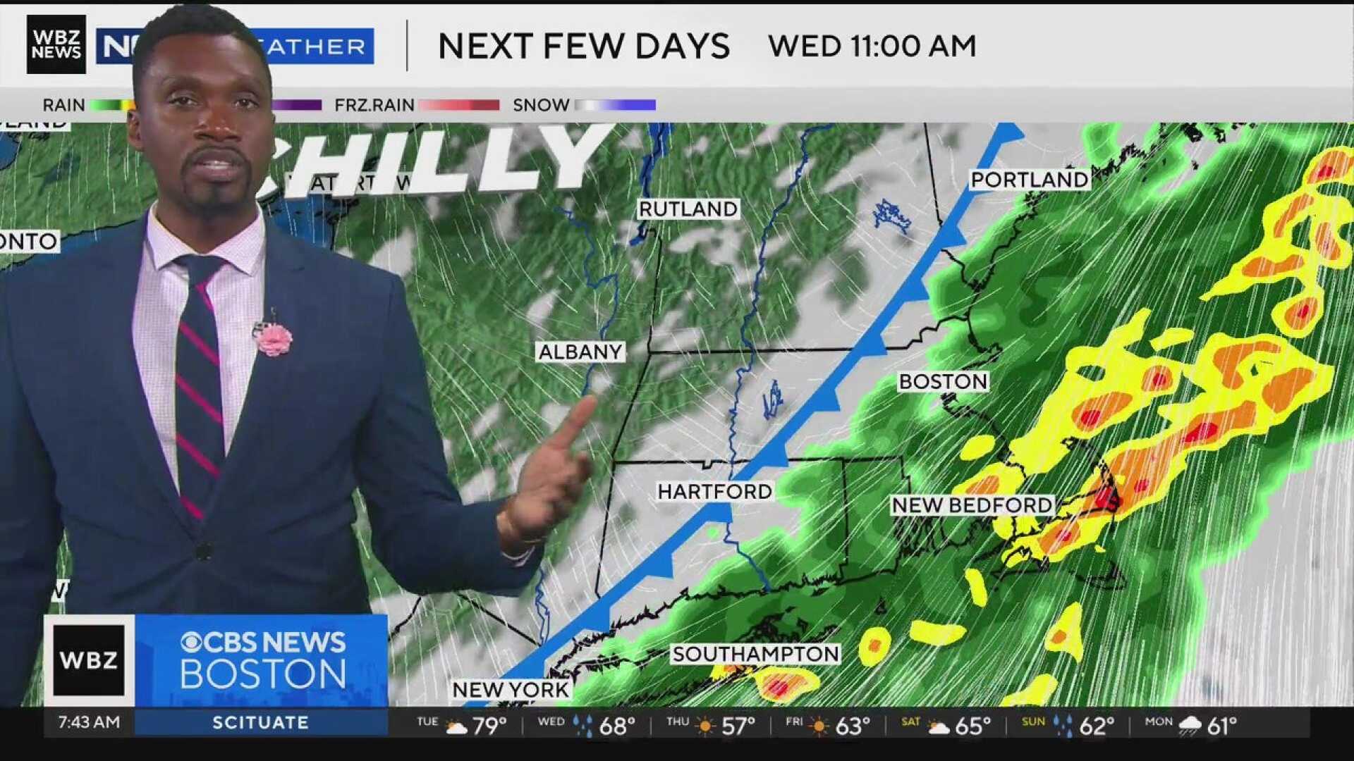
BOSTON, Mass. — Inland areas reached the 80-degree mark for a fourth consecutive day on Tuesday. However, a cold front is approaching, signaling an end to the warm weather and bringing much-needed rainfall on Wednesday.
Morning commuters can expect showers and potential downpours, especially in the Boston region. Rainfall amounts are projected to be between a half an inch to 1½ inches, with heavier downpours possible in some areas. Temperatures will start in the 60s but will feel muggy until the drier air arrives later.
In the afternoon, temperatures are expected to reach the upper 60s. Winds will shift from the southwest to the north as cooler air flows in. Clearing is anticipated before sunset, with temperatures dropping into the 40s by Wednesday night.
Thursday is forecasted to bring sunny skies and a return to more seasonal autumn weather, with highs struggling to reach the mid- to upper 50s. Residents with outdoor plants should take precautions to protect them from potential frost Thursday night into Friday, particularly in colder areas.
Friday’s temperatures will only rebound into the 60s, and there is no frost expected for at least the following week. The weekend appears to be seasonable, with temperatures in the 60s on Saturday and low 60s on Sunday, alongside a chance for showers.
For the Greater Boston area, showers are expected Wednesday morning with highs in the 60s. Central and Western Massachusetts will see similar conditions with clearing later in the day. Southeastern Massachusetts can expect gusty breezes and ending rain by afternoon. The Cape and Islands will experience morning showers, tapering off by night.