Critical Fire Weather Conditions Loom Over Southeast Texas
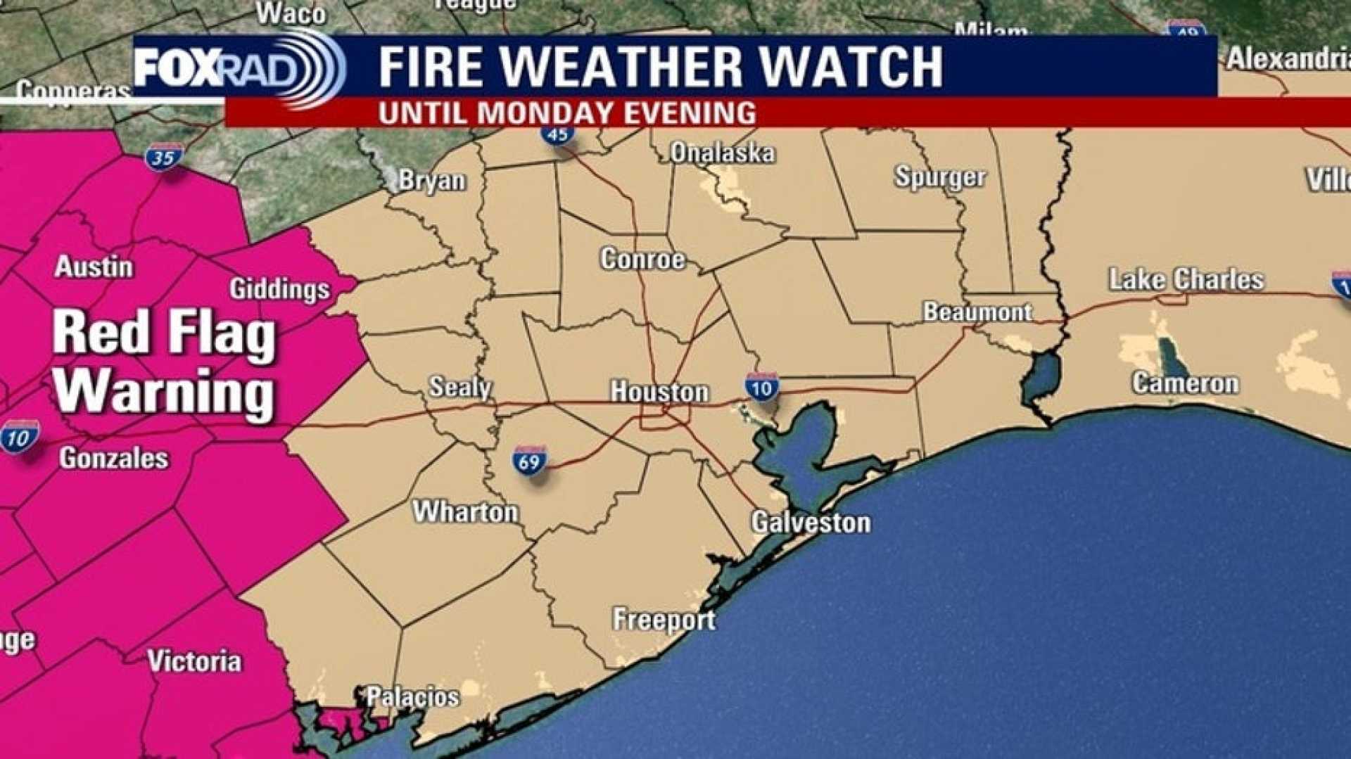
HOUSTON, Texas – Southeast Texas is preparing for critical fire weather conditions on Monday due to gusty northerly winds and dry air. The National Weather Service warns that if a fire forms, it could spread quickly. Authorities recommend avoiding outdoor fires as burn bans remain in effect across the state.
The areas under a burn ban include Polk, Trinity, and Walker Counties, which will last from 9 PM Sunday until 9 AM Monday. Fire safety remains a top priority as the dry conditions persist.
As temperatures shift, folks can expect overnight lows to plunge into the low 40s, with northern regions dipping into the mid- to upper 30s on both Monday and Tuesday mornings. Wind chill factors may make it feel even colder, ranging from the 20s to 30s, prompting families to dress warmly before sending kids to the bus stop.
The last time temperatures were this low was in February, and frost is a possibility during those chilly mornings. Following this cold snap, a return to warmer weather is expected, with temperatures rising back into the 80s by midweek.
Looking ahead, another cold front is forecast to bring rain chances over the weekend, especially from Saturday night into Sunday morning. Meanwhile, the National Weather Service has noted that there is no expectation for tropical cyclone formation in the North Atlantic, Caribbean Sea, or Gulf of America over the next week.
Residents in North and Central Texas are advised to take precautions as a Freeze Watch is in effect until 9 AM Monday. This includes being vigilant for potential ice and hazardous driving conditions as temperatures may fall below freezing.