News
Hurricane Kirk Transitions into Extratropical Storm, Impacts Expected Across Europe
A new weather system, named Hurricane Kirk, has transitioned into an extratropical storm after previously reaching the status of a major hurricane over the North Atlantic. The storm, once a powerful weather event over warmer waters, has weakened considerably as it heads into cooler regions, sparing North America from its potential impact.
According to Darren Bett, Lead Weather Presenter, Kirk was initially a major hurricane over the weekend but transitioned into an extratropical storm as it moved over cooler waters. This transition implies that Kirk is losing the tropical core of energy that powered it, with significant changes observed in its structure. “Since moving north, the inner core of the system has collapsed,” Bett noted. “Deep convection is limited to the northern half of the storm’s circulation.”
Despite its current position over open waters, Kirk has still been responsible for generating large swells and potentially dangerous rip currents. These effects were observed early Monday across parts of the Caribbean, Bermuda, and the east coast of the United States.
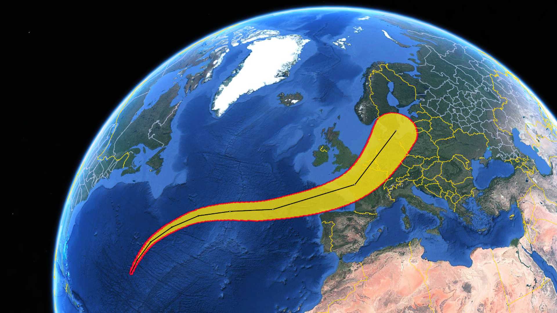
The storm is now part of the fast-moving mid-latitude westerly airflow, with projections suggesting it will pass north of the Azores on Tuesday. Despite its weakened state, Kirk’s winds could still reach over 70 mph (110 km/h) in the northern parts of the Azores archipelago. Additionally, dangerous waves as high as 62 ft (19 m) are expected.
As Kirk advances towards Europe, it is anticipated to reach the Bay of Biscay by Wednesday. Meteorologists forecast that the strongest winds will occur south of the storm’s center, potentially affecting northern Iberia and the Atlantic coast of France with winds exceeding 70 mph (110 km/h). This may likely disrupt ferry services in the Bay of Biscay area. Conversely, surfers along Portugal‘s west coast might benefit from waves as high as 20 ft (6 m).
Kirk’s path will lead to strong winds and heavy rain across parts of continental Europe, impacting countries like France, Belgium, the Netherlands, and Germany. In the UK, however, meteorologists do not foresee severe impacts, as the center of the low pressure is likely to bypass the region, minimizing the effects to a “glancing blow.” Nonetheless, winds across the UK are expected to strengthen on Wednesday night into Thursday, particularly along North Sea coasts where gusts may reach 50 mph (80 km/h) or more.


