Metro Detroit Braces for Winter Storm Expected to Dump 4-7 Inches of Snow
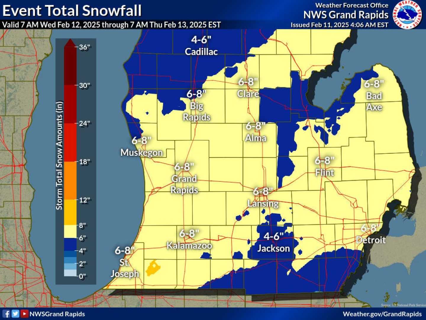
DETROIT – A winter storm is set to impact Metro Detroit beginning Wednesday, February 12, bringing between 4 to 7 inches of snow across the region. The storm is expected to create hazardous travel conditions as snow accumulates throughout the day and into the night.
According to the 4Warn Weather team, snow showers are predicted to start moving into the area around 1 PM on Wednesday, gradually intensifying as they approach the evening commute. By 5 PM, snowfall rates could reach 0.75 inches per hour, significantly reducing visibility and making driving conditions dangerous.
Emmy-award winning meteorologist Kim Adams noted that areas in the Thumb could see up to 7 inches of snow, while southeastern portions of the region, such as Monroe, may experience lower totals of around 2 inches mixed with ice. “Snow will continue overnight, peaking between 11 PM and 3 AM,” Adams explained. “Drivers should be on high alert during this period.”
The National Weather Service has issued a Winter Weather Advisory for several counties in western and southern Metro Detroit, including Wayne, Oakland, and Macomb, effective from 1 PM Wednesday until 7 AM Thursday. This advisory anticipates 3 to 5 inches of snow, with portions of Lenawee, Monroe, and Wayne Counties possibly experiencing ice accumulation that could affect overall snow totals.
Adams detailed the forecast timeline further, stating, “The heaviest snow is expected to fall before dawn on Thursday, with lighter flurries remaining into the morning commute. Conditions should improve later in the morning, but travel may still be impacted.”
For residents planning to travel, the Michigan Department of Transportation urges caution. Ideal driving conditions may not resume until the morning of Thursday, February 13, when the winter storm watch is set to expire. “Be prepared for potential school closures as driving conditions could prove hazardous,” said Adams.
The current storm is part of a pattern of significant winter weather that the region has been experiencing. Following this storm, forecasters are already monitoring another cold front moving in next week, presenting a chance for further snow accumulation.
For updates on the weather advisory and the approaching storm, the public is encouraged to download the 4Warn Weather app, available on both iOS and Android. The app provides real-time updates and alerts directly from the local weather team.